Fichier:Bayou des allemands 2003.jpg

Taille de cet aperçu : 800 × 507 pixels. Autres résolutions : 320 × 203 pixels | 640 × 406 pixels | 1 024 × 649 pixels | 1 500 × 951 pixels.
Fichier d’origine (1 500 × 951 pixels, taille du fichier : 428 kio, type MIME : image/jpeg)
Ce fichier et sa description proviennent de Wikimedia Commons.
| Description |
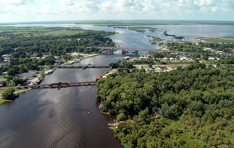
English: Bayou des Allemands and the town of Des Allemands, Louisiana, USA. The bayou empties into Dufrene Ponds (right, top) and Petit Lac Des Allemands (left, top). The bayou is the boundary between St. Charles Parish (left) and Lafourche Parish (right). The three bridges crossing the bayou are (closest to farthest): A railroad bridge, Louisiana State Route 631, and U.S. Route 90. View is to the south. |
|||
| Date | ||||
| Source |
U.S. Army Corps of Engineers Digital Visual Library Image page Image description page Digital Visual Library home page |
|||
| Auteur | Lane Lefort, U.S. Army Corps of Engineers | |||
| Autorisation (Réutilisation de ce fichier) |
|
|||
| Autres versions | en:Image:Bayou des allemands 2003.jpg | |||
| Lieu | Des Allemands, Louisiana, USA |
| Lieu de la prise de vue | | Voir cet endroit et d’autres images sur : OpenStreetMap |
|---|
Historique du fichier
Cliquer sur une date et heure pour voir le fichier tel qu'il était à ce moment-là.
| Date et heure | Vignette | Dimensions | Utilisateur | Commentaire | |
|---|---|---|---|---|---|
| actuel | 8 avril 2007 à 00:21 | | 1 500 × 951 (428 kio) | DanMS | {{Information | Description = {{en|Bayou des Allemands and the town of Des Allemands, Louisiana, USA. The bayou empties into Dufrene Ponds (right, top) and Petit Lac Des Allemands (left, top). The bayou is the boundary between St. Charles Parish (left) |
Utilisation du fichier
Les 2 pages suivantes utilisent ce fichier :
Usage global du fichier
Les autres wikis suivants utilisent ce fichier :
- Utilisation sur en.wikipedia.org