Fichier:Bonnet Carre Spillway aerial view northeast.jpg

Taille de cet aperçu : 750 × 600 pixels. Autres résolutions : 300 × 240 pixels | 600 × 480 pixels | 960 × 768 pixels | 1 280 × 1 024 pixels | 1 500 × 1 200 pixels.
Fichier d’origine (1 500 × 1 200 pixels, taille du fichier : 703 kio, type MIME : image/jpeg)
Ce fichier et sa description proviennent de Wikimedia Commons.
| Description |
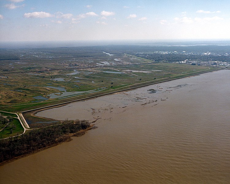
English: The opening of the Bonnet Carré Spillway on the Mississippi River. The spillway is designed to spill water from the river into Lake Pontchartrain during flooding of the river. The spillway is located about 12 miles (20km) west (upriver) of New Orleans, Louisiana, USA. View is to the northeast. Lake Pontchartrain can be seen in the far distance, about 5.5 miles (9 km) distant. |
|||
| Date | ||||
| Source |
U.S. Army Corps of Engineers Digital Visual Library Image page Image description page Digital Visual Library home page |
|||
| Auteur | Michael Maples, U.S. Army Corps of Engineers | |||
| Autorisation (Réutilisation de ce fichier) |
|
|||
| Lieu | Norco, Louisiana, USA |
| Lieu de la prise de vue | | Voir cet endroit et d’autres images sur : OpenStreetMap |
|---|
Historique du fichier
Cliquer sur une date et heure pour voir le fichier tel qu'il était à ce moment-là.
| Date et heure | Vignette | Dimensions | Utilisateur | Commentaire | |
|---|---|---|---|---|---|
| actuel | 6 avril 2007 à 06:17 | | 1 500 × 1 200 (703 kio) | DanMS | {{Information | Description = {{en|The opening of the Bonnet Carré Spillway on the Mississippi River. The spillway is designed to spill water from the river into Lake Pontchartrain during flooding of the river. The spillway is located about 12 miles ( |
Utilisation du fichier
La page suivante utilise ce fichier :
Usage global du fichier
Les autres wikis suivants utilisent ce fichier :
- Utilisation sur de.wikipedia.org
- Utilisation sur en.wikipedia.org