Fichier:British Virgin Islands.jpg

Taille de cet aperçu : 800 × 533 pixels. Autres résolutions : 320 × 213 pixels | 640 × 427 pixels | 1 024 × 683 pixels | 1 280 × 853 pixels | 2 700 × 1 800 pixels.
Fichier d’origine (2 700 × 1 800 pixels, taille du fichier : 2,89 Mio, type MIME : image/jpeg)
Ce fichier et sa description proviennent de Wikimedia Commons.
Description
| Description |
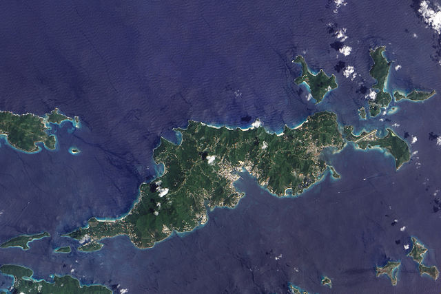
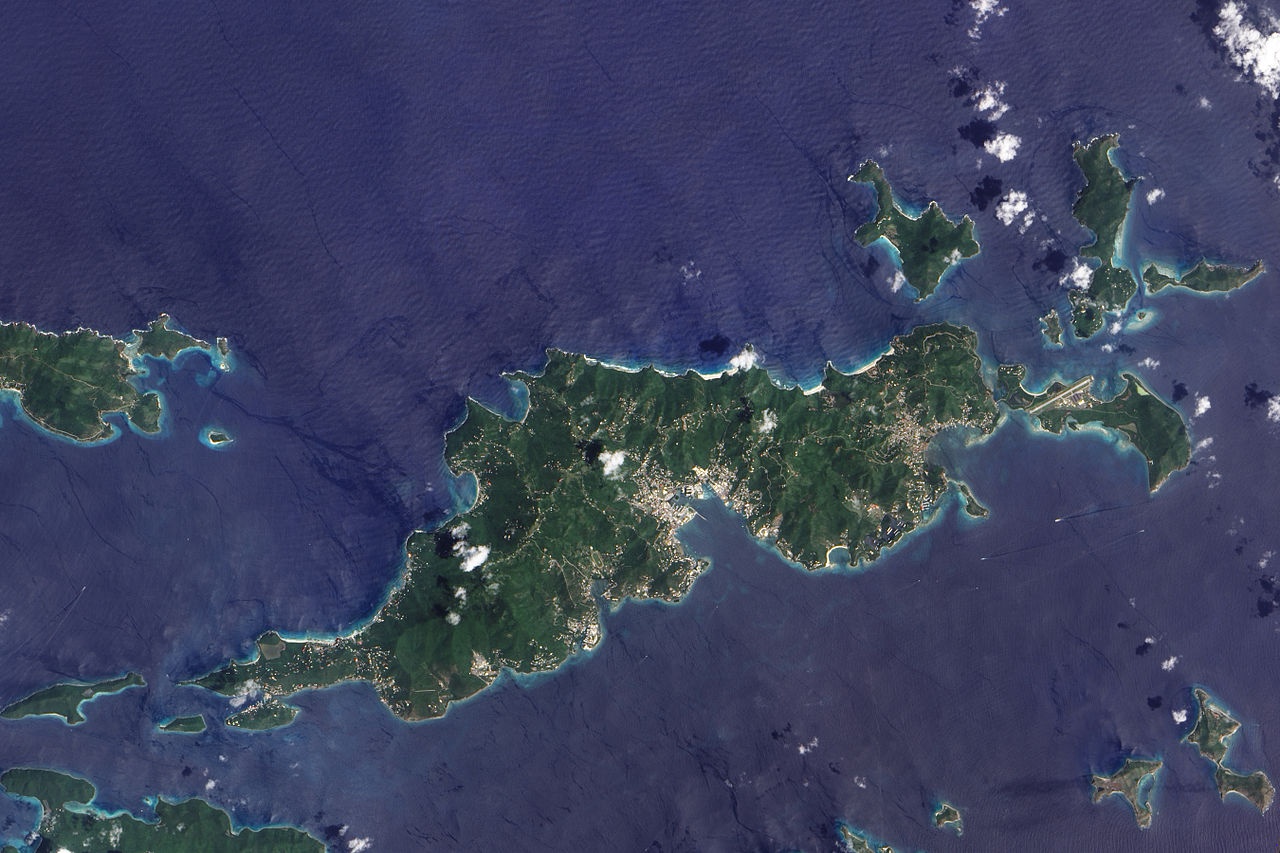
English: This true-colour image of Tortola and its smaller neighbours, Guana Island, Grand Camanoe, and Beef Island. The islands follow a roughly south-west-north-east trajectory. Gray-beige urbanized areas cling to the coast while Tortola’s interior remains mostly green, an arrangement driven by the islands’s topography. The biggest settlement fringes Road Bay. A straight line crossing Beef Island gives away the location of a small airport. Tortola’s carpet of green suggests a lush rainforest, but the island actually supports a patch of drought-resistant forest, in addition to plants accustomed to more water. Tortola’s climate and land surface are well suited to raising livestock, but tourism and financial services are the primary industries. |
| Date | |
| Source | NASA Earth Observatory |
| Auteur | Jesse Allen |
Image captured by the Advanced Land Imager (ALI) on NASA’s Earth Observing-1 (EO-1) satellite. Image created using EO-1 ALI data provided courtesy of the NASA EO-1 team and the United States Geological Survey. Instrument: EO-1 - ALI.
Conditions d’utilisation
| Ce fichier provient de la NASA. Sauf exception, les documents créés par la NASA ne sont pas soumis à copyright. Pour plus d'informations, voir la politique de copyright de la NASA. | ||
 |
Attention :
|
| Annotations | Cette image est annotée : Voir les annotations sur Wikimedia Commons |
Historique du fichier
Cliquer sur une date et heure pour voir le fichier tel qu'il était à ce moment-là.
| Date et heure | Vignette | Dimensions | Utilisateur | Commentaire | |
|---|---|---|---|---|---|
| actuel | 30 novembre 2009 à 14:06 | | 2 700 × 1 800 (2,89 Mio) | Originalwana | {{Information |Description={{en|1=This true-colour image of Tortola and its smaller neighbours, Guana Island, Grand Camanoe, and Beef Island. The islands follow a roughly south-west-north-east trajectory. Gray-beige urbanized areas c |
Utilisation du fichier
Aucune page n’utilise ce fichier.
Usage global du fichier
Les autres wikis suivants utilisent ce fichier :
- Utilisation sur af.wikipedia.org
- Utilisation sur ar.wikipedia.org
- Utilisation sur arz.wikipedia.org
- Utilisation sur ast.wikipedia.org
- Utilisation sur ca.wikipedia.org
- Utilisation sur cy.wikipedia.org
- Utilisation sur da.wikipedia.org
- Utilisation sur en.wikipedia.org
- Utilisation sur eo.wikipedia.org
- Utilisation sur fr.wikivoyage.org
- Utilisation sur ga.wikipedia.org
- Utilisation sur gl.wikipedia.org
- Utilisation sur ht.wikipedia.org
- Utilisation sur pap.wikipedia.org
- Utilisation sur pl.wikipedia.org
- Utilisation sur ru.wikinews.org
- Utilisation sur tl.wikipedia.org
- Utilisation sur tt.wikipedia.org
- Utilisation sur uk.wikipedia.org
- Utilisation sur vec.wikipedia.org
- Utilisation sur www.wikidata.org