Fichier:C77190s1 Ant.Map Ross Island.jpg
Taille de cet aperçu : 800 × 508 pixels. Autres résolutions : 320 × 203 pixels | 640 × 406 pixels | 1 024 × 650 pixels | 1 280 × 813 pixels | 2 560 × 1 625 pixels | 5 118 × 3 249 pixels.
Fichier d’origine (5 118 × 3 249 pixels, taille du fichier : 1,95 Mio, type MIME : image/jpeg)
Ce fichier et sa description proviennent de Wikimedia Commons.
| Description |
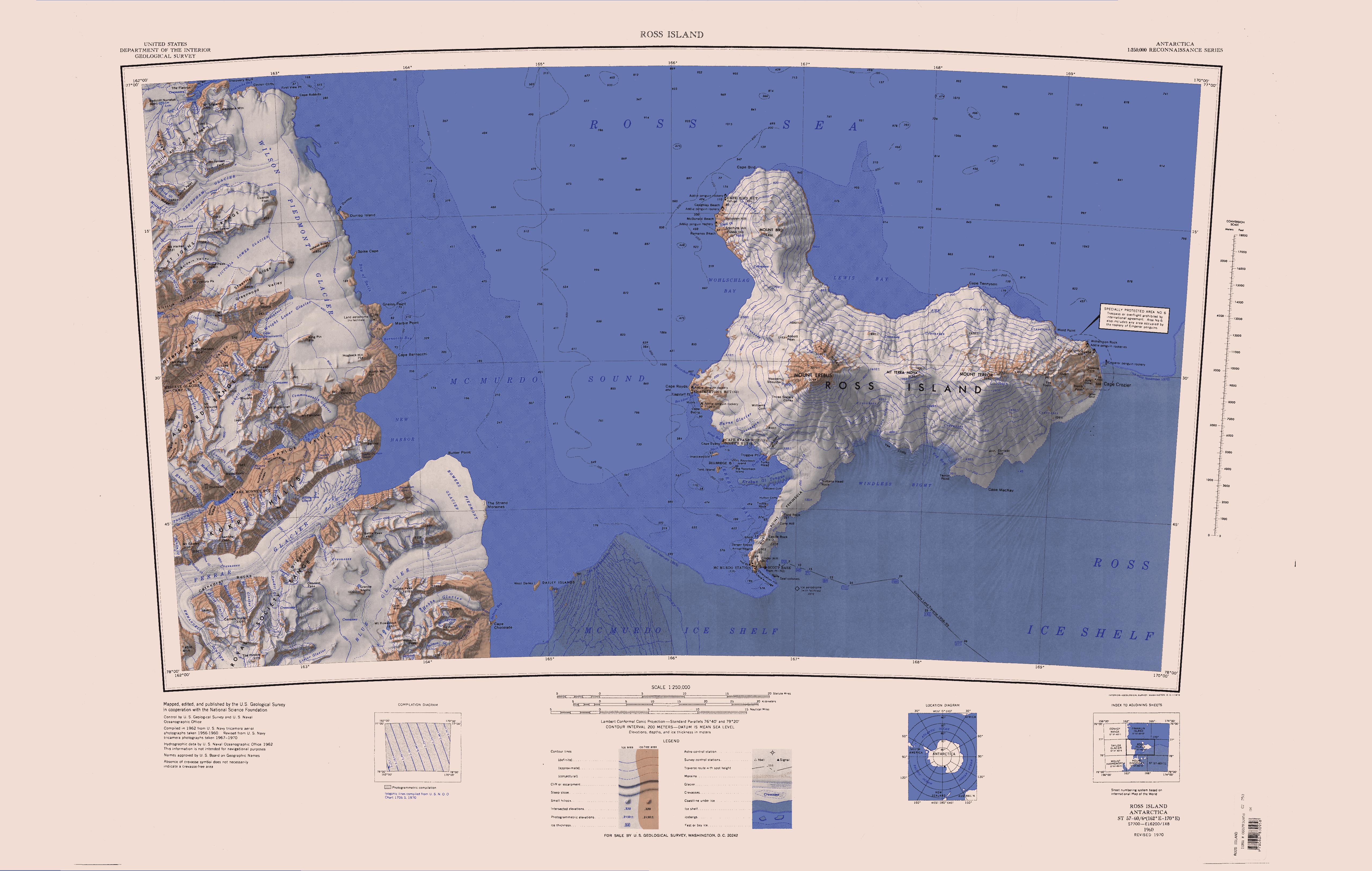
English: Map of Antarctica by the United States Antarctic Resource Center of the US Geological Society. |
| Source | USGS |
| Auteur | USGS |
| Autres versions | File:Ross Island Topographic Map USGS.png : Higher quality PNG version |
Cette image est placée dans le domaine public parce qu'elle contient des éléments issus de l'United States Geological Survey, une agence du Département de l'Intérieur des États-Unis. Pour plus d'information, consultez la politique officielle de copyright de l'USGS (en anglais)
|
Historique du fichier
Cliquer sur une date et heure pour voir le fichier tel qu'il était à ce moment-là.
| Date et heure | Vignette | Dimensions | Utilisateur | Commentaire | |
|---|---|---|---|---|---|
| actuel | 15 avril 2005 à 14:01 | | 5 118 × 3 249 (1,95 Mio) | Achim Raschka | Map of Antarctica by the United States Antarctic Ressource Center of the US Geological Society. {{PD-US}} Copyrights and Trademarks USGS-authored or produced data and information are in the public domain. While the content of most USGS web pages is in th |
Utilisation du fichier
Les 2 pages suivantes utilisent ce fichier :
Usage global du fichier
Les autres wikis suivants utilisent ce fichier :
- Utilisation sur ceb.wikipedia.org
- Utilisation sur de.wikipedia.org
- Meserve-Gletscher
- Antarktische Trockentäler
- Tschadsee (Antarktika)
- Dailey Islands
- Marble Point
- Kap Roberts
- Wilson-Piedmont-Gletscher
- Kap Bernacchi
- Bernacchi-Bucht
- Bowers-Piedmont-Gletscher
- Blue Glacier
- Denton Hills
- Staeffler Ridge
- Matterhorn (Viktorialand)
- Lacroix-Gletscher
- Matterhorn-Gletscher
- Debenham-Gletscher
- Gonville and Caius Range
- Arnold Cove
- Gneiss Point
- Redcliff-Nunatak
- Borns-Gletscher
- Mount Coates (Viktorialand)
- Briggs Hill
- Descent-Pass
- Brodie Ponds
- Kuechle Island
- West Dailey Island
- Utilisation sur en.wikipedia.org
Voir davantage sur l’utilisation globale de ce fichier.