Fichier:Canada change 1870-07-15.png
Fichier d’origine (1 800 × 1 496 pixels, taille du fichier : 510 kio, type MIME : image/png)
Ce fichier et sa description proviennent de Wikimedia Commons.
Description
| Description |
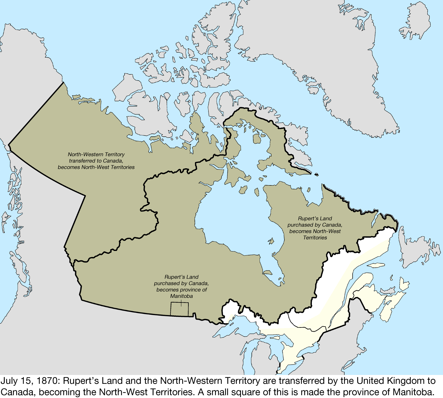
English: Map of the change to Canada on July 15, 1870.
The United Kingdom transferred most of its remaining land in North America to Canada, with the North-Western Territory and Rupert's Land becoming the North-West Territories. Rupert's Land was transferred to Canada in 1869,[1] but the transfer was only consummated in 1870 when £300,000 was paid to the Hudson's Bay Company.[2] Due to a vague description and lack of quality surveying, part of the western border with the United States was unclear and disputed.[3] Canada disagreed with the United Kingdom over the extent of Labrador that remained with Newfoundland Colony, citing the historical use of the term "Coasts of Labrador." A rectangular area of the newly acquired region around the city of Winnipeg was made the province of Manitoba.[4] This was built with the shapefiles:
|
| Date | |
| Source | Travail personnel |
| Auteur | Golbez |
Conditions d’utilisation
- Vous êtes libre :
- de partager – de copier, distribuer et transmettre cette œuvre
- d’adapter – de modifier cette œuvre
- Sous les conditions suivantes :
- paternité – Vous devez donner les informations appropriées concernant l'auteur, fournir un lien vers la licence et indiquer si des modifications ont été faites. Vous pouvez faire cela par tout moyen raisonnable, mais en aucune façon suggérant que l’auteur vous soutient ou approuve l’utilisation que vous en faites.
- partage à l’identique – Si vous modifiez, transformez, ou vous basez sur cette œuvre, vous devez distribuer votre contribution sous la même licence ou une licence compatible avec celle de l’original.
Historique du fichier
Cliquer sur une date et heure pour voir le fichier tel qu'il était à ce moment-là.
| Date et heure | Vignette | Dimensions | Utilisateur | Commentaire | |
|---|---|---|---|---|---|
| actuel | 11 juin 2024 à 22:23 | | 1 800 × 1 496 (510 kio) | Golbez | New version. |
| 20 janvier 2017 à 02:42 |  | 1 500 × 1 348 (401 kio) | Golbez |
Utilisation du fichier
La page suivante utilise ce fichier :
Usage global du fichier
Les autres wikis suivants utilisent ce fichier :
- Utilisation sur en.wikipedia.org
- Utilisation sur sr.wikipedia.org