Fichier:Cornish windsor bridge.jpg
Taille de cet aperçu : 800 × 560 pixels. Autres résolutions : 320 × 224 pixels | 640 × 448 pixels | 1 024 × 717 pixels | 1 280 × 896 pixels | 2 560 × 1 793 pixels | 4 567 × 3 198 pixels.
Fichier d’origine (4 567 × 3 198 pixels, taille du fichier : 1,49 Mio, type MIME : image/jpeg)
Ce fichier et sa description proviennent de Wikimedia Commons.
|
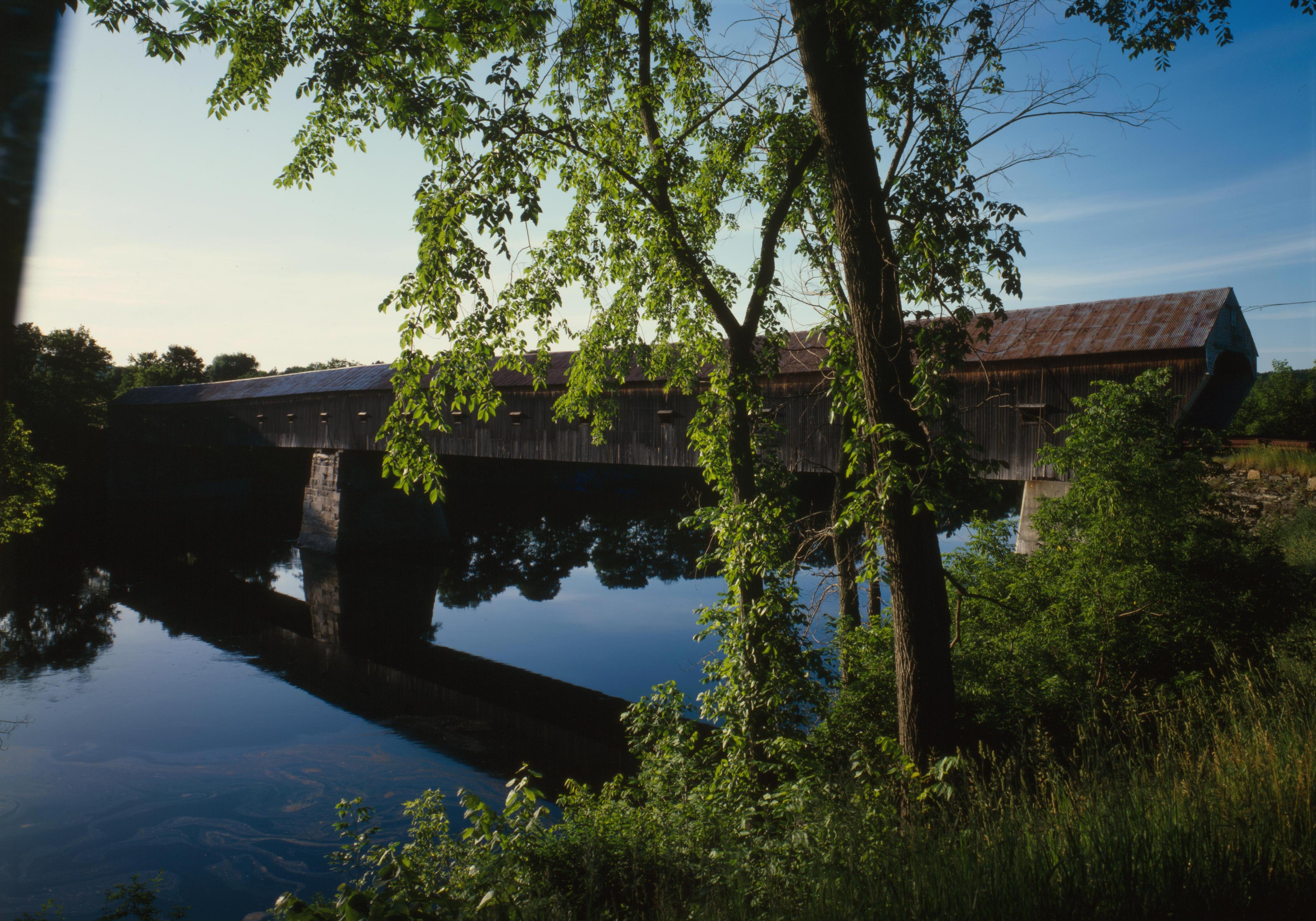
Ceci est une photographie d’un monument référencé dans le National Register of Historic Places des États-Unis sous le numéro 76000135. |
| Lieu de la prise de vue | | Voir cet endroit et d’autres images sur : OpenStreetMap |
|---|
| Description |
English: Southern (downstream) side of the Cornish-Windsor Covered Bridge, which spans the end of the Zoarville Bridge, which spans the Connecticut River between Cornish, New Hampshire and Windsor, Vermont, in the United States. Built in 1866, it is listed on the National Register of Historic Places. |
|||||||||||||||||||||||
| Date | ||||||||||||||||||||||||
| Source | Library of Congress, Prints and Photograph Division HAER: NH,10-CORN,2-11 | |||||||||||||||||||||||
| Auteur |
|
|||||||||||||||||||||||
| Autorisation (Réutilisation de ce fichier) |
|
|||||||||||||||||||||||
.jpg)

|
Cette image est disponible sur la Prints and Photographs division de la Bibliothèque du Congrès des États-Unis sous le numéro d’identification hhh.nh0177.
Ce bandeau n’indique rien sur le statut de l’œuvre au regard du droit d'auteur. Un bandeau de droit d’auteur est requis. Voir Commons:À propos des licences pour plus d’informations.
|
Historique du fichier
Cliquer sur une date et heure pour voir le fichier tel qu'il était à ce moment-là.
| Date et heure | Vignette | Dimensions | Utilisateur | Commentaire | |
|---|---|---|---|---|---|
| actuel | 6 septembre 2009 à 19:32 | | 4 567 × 3 198 (1,49 Mio) | Cropbot | upload cropped version, operated by User:Finavon. Summary: border cropped |
| 14 août 2009 à 07:07 |  | 4 911 × 3 556 (1,69 Mio) | Nyttend | {{Location|43|28|26|N|72|23|1|W}} {{Information |Description={{en|Southern (downstream) side of the {{w|Cornish-Windsor Covered Bridge}}, which spans the end of the {{w|Zoarville Bridge}}, which spans the {{w|Connecticut River}} between {{w|Cornish, New H |
Utilisation du fichier
La page suivante utilise ce fichier :
Usage global du fichier
Les autres wikis suivants utilisent ce fichier :
- Utilisation sur ar.wikipedia.org
- Utilisation sur de.wikipedia.org
- Utilisation sur en.wikipedia.org
- Windsor, Vermont
- List of Historic Civil Engineering Landmarks
- National Register of Historic Places listings in Windsor County, Vermont
- Portal:U.S. roads/Did you know
- List of bridges on the National Register of Historic Places in New Hampshire
- List of bridges on the National Register of Historic Places in Vermont
- Portal:U.S. roads/Did you know/October 2011
- User:Eurodog/sandbox153
- Utilisation sur es.wikipedia.org
- Utilisation sur vi.wikipedia.org
- Utilisation sur zh.wikipedia.org