Fichier:Creek Turnpike path.png
Taille de cet aperçu : 800 × 471 pixels. Autres résolutions : 320 × 188 pixels | 640 × 376 pixels | 1 024 × 602 pixels | 1 280 × 753 pixels | 3 264 × 1 920 pixels.
Fichier d’origine (3 264 × 1 920 pixels, taille du fichier : 1,13 Mio, type MIME : image/png)
Ce fichier et sa description proviennent de Wikimedia Commons.
Description
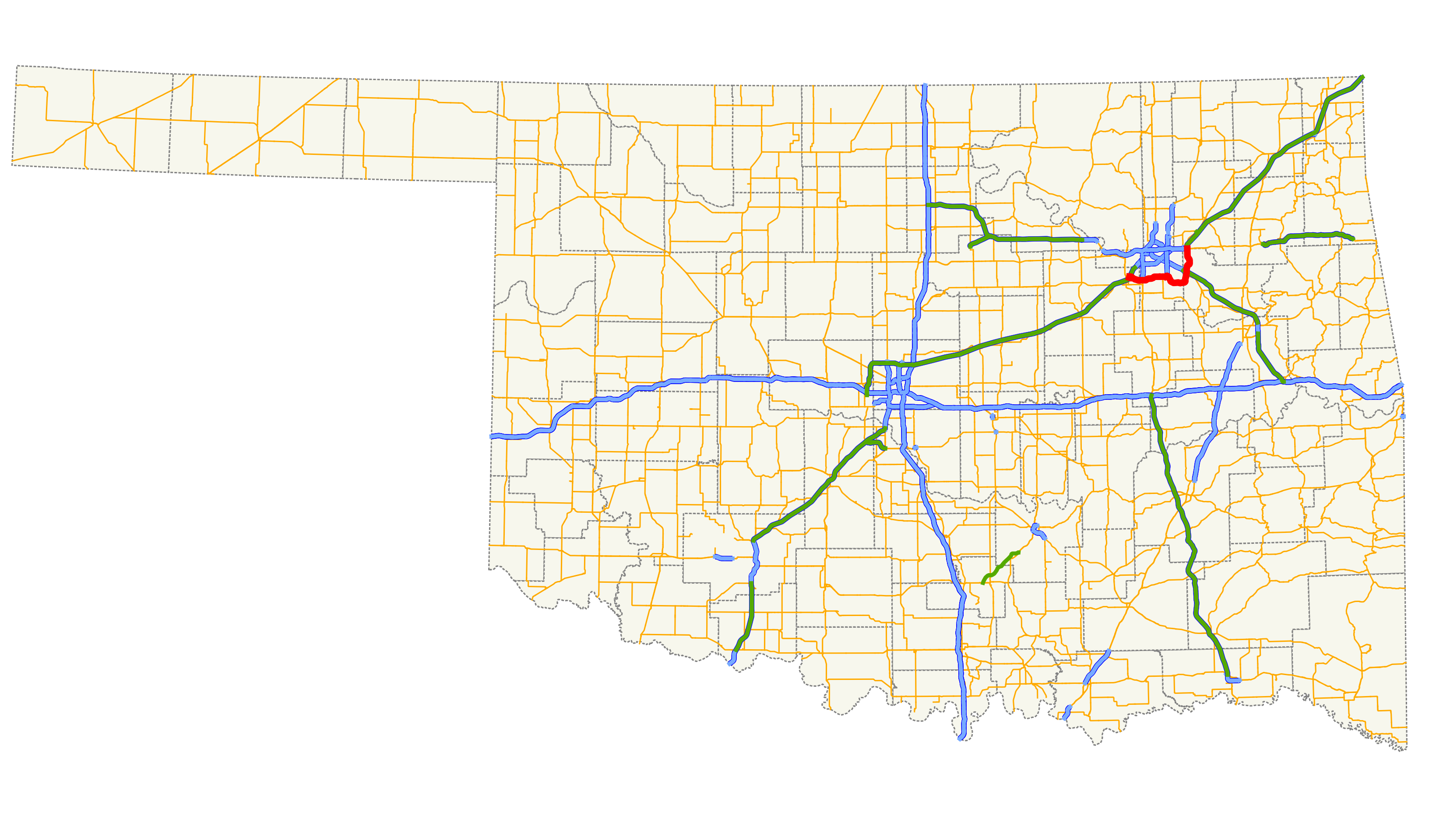
| Description | Map of the Creek Turnpike within the state of Oklahoma. |
| Date | |
| Source |
Self-made in QGIS using data from http://www.odot.org Cette PNG image matricielle a été créée avec QGIS |
| Auteur | Scott5114 |
| Autorisation (Réutilisation de ce fichier) |
PD |
Legend
| Roads | Borders | ||||||||||||||
|---|---|---|---|---|---|---|---|---|---|---|---|---|---|---|---|
|
|
Conditions d’utilisation
| Moi, propriétaire des droits d’auteur sur cette œuvre, la place dans le domaine public. Ceci s'applique dans le monde entier. Dans certains pays, ceci peut ne pas être possible ; dans ce cas : J’accorde à toute personne le droit d’utiliser cette œuvre dans n’importe quel but, sans aucune condition, sauf celles requises par la loi. |
Historique du fichier
Cliquer sur une date et heure pour voir le fichier tel qu'il était à ce moment-là.
| Date et heure | Vignette | Dimensions | Utilisateur | Commentaire | |
|---|---|---|---|---|---|
| actuel | 12 mars 2013 à 09:55 | | 3 264 × 1 920 (1,13 Mio) | Scott5114 | == {{int:filedesc}} == {{Information |Description=Map of the Creek Turnpike within the state of Oklahoma. |Source=self-made in QGIS {{QGIS}} |Date=March 12, 2013 |Author=Scott5114 |Permission=PD |other_versions= }} {{US road map legend}} [[Catego... |
Utilisation du fichier
La page suivante utilise ce fichier :
Usage global du fichier
Les autres wikis suivants utilisent ce fichier :
- Utilisation sur www.wikidata.org