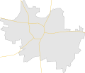
Fichier:Debrecen map.svg

Taille de cet aperçu PNG pour ce fichier SVG : 694 × 600 pixels. Autres résolutions : 278 × 240 pixels | 556 × 480 pixels | 889 × 768 pixels | 1 185 × 1 024 pixels | 2 371 × 2 048 pixels | 1 631 × 1 409 pixels.
Fichier d’origine (Fichier SVG, nominalement de 1 631 × 1 409 pixels, taille : 10 kio)
Historique du fichier
Cliquer sur une date et heure pour voir le fichier tel qu'il était à ce moment-là.
| Date et heure | Vignette | Dimensions | Utilisateur | Commentaire | |
|---|---|---|---|---|---|
| actuel | 1 septembre 2009 à 17:47 |  | 1 631 × 1 409 (10 kio) | BáthoryPéter | {{Information |Description={{en|1=Map of en:Debrecen}} {{hu|1=hu:Debrecen térképe}} |Source=own work |Author=~~~ |Date=2009-09-01 |Permission= |other_versions= }} Category:Maps of cities in Hungary |
Utilisation du fichier
La page suivante utilise ce fichier :
Usage global du fichier
Les autres wikis suivants utilisent ce fichier :
- Utilisation sur he.wikipedia.org
- Utilisation sur pl.wikipedia.org
- Uniwersytet w Debreczynie
- Katedra Świętej Anny w Debreczynie
- Port lotniczy Debreczyn
- Stadion Lekkoatletyczny im. Istvána Gyuli
- Oláh Gábor utcai stadion
- Nagyerdei Stadion
- Moduł:Mapa/dane/Debreczyn
- Moduł:Mapa/dane/HU-DE
- Hódos Imre Rendezvénycsarnok
- Wielki Kościół Ewangelicki w Debreczynie
- Obóz dla uchodźców w Debreczynie
- Nagyerdei Stadion (1934–2013)
- Vágóhíd utcai Stadion
- Egyetemi Sporttelep
- Főnix Aréna
- Utilisation sur pl.wikibooks.org
- Utilisation sur vep.wikipedia.org
