Fichier:Dennis 2005-07-10 1615Z (alternate).jpg

Fichier d’origine (6 800 × 8 800 pixels, taille du fichier : 9,37 Mio, type MIME : image/jpeg)
Ce fichier et sa description proviennent de Wikimedia Commons.
| Avertissement | Certains navigateurs peuvent avoir des difficultés à afficher cette image à sa résolution complète : elle possède un nombre de pixels singulièrement élevé et peut ne pas se charger correctement ou faire planter votre navigateur. |
|---|
Description
| Description |
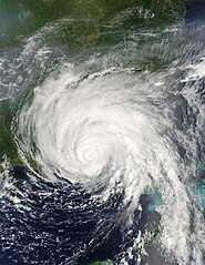
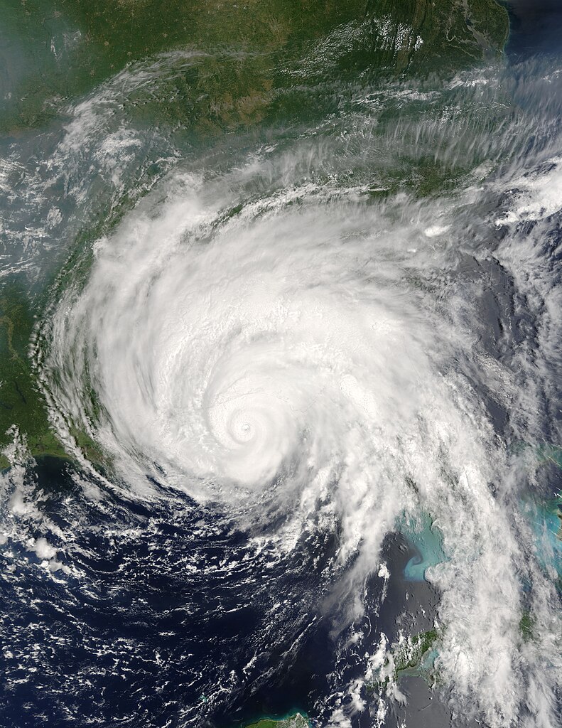
Hurricane Dennis was bearing down on the Gulf Coast of the United States on July 10, 2005, at 12:15 p.m. (16:15 UTC) when the Moderate Resolution Imaging Spectroradiometer on NASA's Terra satellite captured this image. With winds of 140 miles per hour (225 kph), Dennis was a powerful Category 4 storm just hours away from making landfall. At the time this image was taken, the eye of the storm was about 55 miles (90 kilometers) south, southeast of Pensacola, Florida, and the storm was moving northwest at about 18 miles per hour (29 kph). The size of the storm put clouds of rain over most of the southeastern United States well before the storm came ashore. In this image, Dennis covers all of Florida, Alabama, Mississippi, and stretches over parts of Louisiana. The northern fringes of the storm appear to be over Tennessee and North Carolina. For additional information and warnings about this storm, please visit the National Hurricane Center. This image is available in additional resolutions from the MODIS Rapid Response Team. |
|||||
| Date | ||||||
| Source | http://earthobservatory.nasa.gov/NaturalHazards/natural_hazards_v2.php3?img_id=12947 | |||||
| Auteur | NASA image courtesy Jacques Descloitres, MODIS Rapid Response Team, NASA GSFC | |||||
| Autorisation (Réutilisation de ce fichier) |
|
|||||
| Autres versions | Image:Hurricane Dennis 7102005.jpg |

.jpg?uselang=fr)
Historique du fichier
Cliquer sur une date et heure pour voir le fichier tel qu'il était à ce moment-là.
| Date et heure | Vignette | Dimensions | Utilisateur | Commentaire | |
|---|---|---|---|---|---|
| actuel | 22 octobre 2006 à 03:20 | | 6 800 × 8 800 (9,37 Mio) | Good kitty | == Summary == {{Information |Description=Hurricane Dennis was bearing down on the Gulf Coast of the United States on July 10, 2005, at 12:15 p.m. (16:15 UTC) when the Moderate Resolution Imaging Spectroradiometer on NASA's Terra satellite captured this im |
Utilisation du fichier
Les 2 pages suivantes utilisent ce fichier :
Usage global du fichier
Les autres wikis suivants utilisent ce fichier :
- Utilisation sur ar.wikipedia.org
- Utilisation sur ca.wikipedia.org
- Utilisation sur en.wikipedia.org
- Hurricane Dennis
- Timeline of the 2005 Atlantic hurricane season
- Portal:Cuba/Did you know
- Portal:Cuba/Did you know/9
- List of the wettest tropical cyclones in the United States
- Effects of Hurricane Dennis in Florida
- Effects of Hurricane Dennis in Alabama
- Effects of Hurricane Dennis in Georgia
- Effects of Hurricane Dennis in Mississippi
- Portal:Tropical cyclones/Featured article/Effects of Hurricane Dennis in Florida
- Template:Hurricane Dennis series
- List of natural disasters in Haiti
- Effects of Hurricane Dennis in Jamaica
- User:IPhonehurricane95/Picture of the day/Hurricane Dennis
- Meteorological history of Hurricane Dennis
- Effects of Hurricane Dennis in Haiti
- Utilisation sur es.wikipedia.org
- Utilisation sur eu.wikipedia.org
- Utilisation sur ht.wikipedia.org
- Utilisation sur hu.wikipedia.org
- Utilisation sur no.wikipedia.org
- Utilisation sur pl.wikipedia.org
- Utilisation sur pt.wikipedia.org
- Utilisation sur ro.wikipedia.org
- Utilisation sur simple.wikipedia.org
- Utilisation sur sv.wikipedia.org
- Utilisation sur www.wikidata.org
- Utilisation sur zh.wikipedia.org
.jpg)