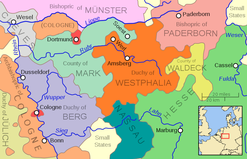
Fichier:Duchy of Wesphalia and other states, circa 1645.svg

Taille de cet aperçu PNG pour ce fichier SVG : 800 × 516 pixels. Autres résolutions : 320 × 206 pixels | 640 × 413 pixels | 1 024 × 660 pixels | 1 280 × 826 pixels | 2 560 × 1 651 pixels.
Fichier d’origine (Fichier SVG, nominalement de 800 × 516 pixels, taille : 176 kio)
Historique du fichier
Cliquer sur une date et heure pour voir le fichier tel qu'il était à ce moment-là.
| Date et heure | Vignette | Dimensions | Utilisateur | Commentaire | |
|---|---|---|---|---|---|
| actuel | 6 mai 2011 à 14:44 |  | 800 × 516 (176 kio) | Ras67 | valid svg code |
| 6 mai 2011 à 04:45 |  | 800 × 516 (144 kio) | Ras67 | frame removed, 800px | |
| 16 octobre 2009 à 05:03 |  | 704 × 459 (216 kio) | MapMaster | Needed to change page size to properly reflect enlarged drawing | |
| 15 octobre 2009 à 22:48 |  | 352 × 229 (216 kio) | MapMaster | More river names, strict font usage, twice as large. | |
| 15 octobre 2009 à 18:42 |  | 352 × 229 (208 kio) | MapMaster | {{Information |Description={{en|1=A map showing the Duchy of Westphalia and other eastern German states in the year 1645.}} |Source=Own work |Author=MapMaster |Date=15 October 2009 |Permission= |other_versions= }} [[Category:Maps of th |
Utilisation du fichier
Les 2 pages suivantes utilisent ce fichier :
Usage global du fichier
Les autres wikis suivants utilisent ce fichier :
- Utilisation sur bg.wikipedia.org
- Utilisation sur cs.wikipedia.org
- Utilisation sur es.wikipedia.org
- Utilisation sur et.wikipedia.org
- Utilisation sur it.wikipedia.org
- Utilisation sur ja.wikipedia.org
- Utilisation sur ru.wikipedia.org