Fichier:Eckert4.jpg

Taille de cet aperçu : 800 × 400 pixels. Autres résolutions : 320 × 160 pixels | 640 × 320 pixels | 1 024 × 512 pixels | 1 280 × 640 pixels | 2 560 × 1 280 pixels | 5 400 × 2 700 pixels.
Fichier d’origine (5 400 × 2 700 pixels, taille du fichier : 1,56 Mio, type MIME : image/jpeg)
Ce fichier et sa description proviennent de Wikimedia Commons.
Description
| Description |
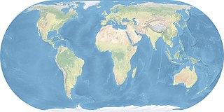
English: World map made with natural earth data, Eckert 4 projection, central meridian 10° east. "Mit offenen Karten" (ARTE-TV) uses this projection.
Deutsch: Weltkarte erstellt mit Natural Earth Daten, Eckert 4 Projektion, zentraler Meridian 10° Ost. Diese Projektion wird von der Arte-Serie "Mit offenen Karten" verwendet. |
|||
| Source | Travail personnel | |||
| Auteur | Ktrinko | |||
| Autorisation (Réutilisation de ce fichier) |
Moi, en tant que détenteur des droits d’auteur sur cette œuvre, je la publie sous la licence suivante :
|
Historique du fichier
Cliquer sur une date et heure pour voir le fichier tel qu'il était à ce moment-là.
| Date et heure | Vignette | Dimensions | Utilisateur | Commentaire | |
|---|---|---|---|---|---|
| actuel | 4 mai 2017 à 17:04 | | 5 400 × 2 700 (1,56 Mio) | ديفيد عادل وهبة خليل 2 | Reverted to version as of 18:06, 29 October 2011 (UTC) |
| 2 mai 2017 à 15:44 |  | 2 448 × 2 080 (1,22 Mio) | FahdAbiRashed | طريق الحرير الجديد | |
| 29 octobre 2011 à 20:06 |  | 5 400 × 2 700 (1,56 Mio) | Ktrinko | {{Information |Description ={{en|1=world map made with natural earth data, eckert 4 projection, central meridian 10 ° east}} {{de|1=Weltkarte erstellt mit Natural Earth Daten, Eckert 4 Projektion, zentraler Meridian 10 ° Ost}} |Source ={{own} |
Utilisation du fichier
Les 3 pages suivantes utilisent ce fichier :
Usage global du fichier
Les autres wikis suivants utilisent ce fichier :
- Utilisation sur cs.wikipedia.org
- Utilisation sur da.wikipedia.org
- Utilisation sur en.wikipedia.org
- Utilisation sur es.wikipedia.org
- Utilisation sur es.wikiversity.org
- Utilisation sur he.wikivoyage.org
- Utilisation sur jv.wikipedia.org
- Utilisation sur lv.wikipedia.org
- Utilisation sur tr.wikipedia.org
- Utilisation sur zh.wikipedia.org