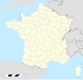
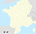
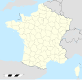
Fichier:France location map-Departements 1798.svg

Taille de cet aperçu PNG pour ce fichier SVG : 624 × 600 pixels. Autres résolutions : 250 × 240 pixels | 499 × 480 pixels | 799 × 768 pixels | 1 066 × 1 024 pixels | 2 131 × 2 048 pixels | 2 000 × 1 922 pixels.
Fichier d’origine (Fichier SVG, nominalement de 2 000 × 1 922 pixels, taille : 890 kio)
Historique du fichier
Cliquer sur une date et heure pour voir le fichier tel qu'il était à ce moment-là.
| Date et heure | Vignette | Dimensions | Utilisateur | Commentaire | |
|---|---|---|---|---|---|
| actuel | 10 mai 2015 à 18:57 |  | 2 000 × 1 922 (890 kio) | Flappiefh | Fixed borders for Moselle and Bas-Rhin. |
| 9 mai 2015 à 22:51 |  | 2 000 × 1 922 (809 kio) | Flappiefh | Added 9 departments in today's Belgium. | |
| 8 mai 2015 à 23:11 |  | 2 000 × 1 922 (564 kio) | Flappiefh | Fixed Barcillonnette canton. | |
| 8 mai 2015 à 19:43 |  | 2 000 × 1 922 (563 kio) | Flappiefh | Added two departments in Corsica. | |
| 8 mai 2015 à 19:11 |  | 2 000 × 1 922 (562 kio) | Flappiefh | Added Léman department. | |
| 8 mai 2015 à 18:36 |  | 2 000 × 1 922 (568 kio) | Flappiefh | Added missing border between Doubs and Haut-Rhin. | |
| 8 mai 2015 à 18:24 |  | 2 000 × 1 922 (587 kio) | Flappiefh | User created page with UploadWizard |
Utilisation du fichier
La page suivante utilise ce fichier :


