Fichier:Golan location map 2.PNG

Taille de cet aperçu : 759 × 599 pixels. Autres résolutions : 304 × 240 pixels | 608 × 480 pixels | 936 × 739 pixels.
Fichier d’origine (936 × 739 pixels, taille du fichier : 140 kio, type MIME : image/png)
Ce fichier et sa description proviennent de Wikimedia Commons.
Description
| Description |
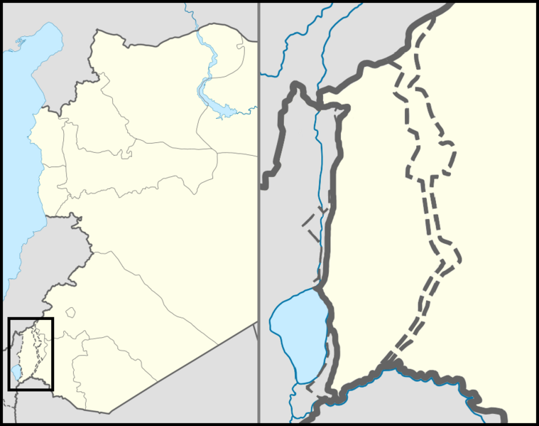
English: Location map of the Golan Heights. |
| Date | |
| Source | |
| Auteur | |
| Autorisation (Réutilisation de ce fichier) |
Creative Commons Attribution-Share Alike 3.0 Unported |
| Autres versions | File:Golan location map 3.PNG |
Conditions d’utilisation
Ce fichier est disponible selon les termes de la licence Creative Commons Attribution 3.0 Non transposée.
- Vous êtes libre :
- de partager – de copier, distribuer et transmettre cette œuvre
- d’adapter – de modifier cette œuvre
- Sous les conditions suivantes :
- paternité – Vous devez donner les informations appropriées concernant l'auteur, fournir un lien vers la licence et indiquer si des modifications ont été faites. Vous pouvez faire cela par tout moyen raisonnable, mais en aucune façon suggérant que l’auteur vous soutient ou approuve l’utilisation que vous en faites.
Historique du fichier
Cliquer sur une date et heure pour voir le fichier tel qu'il était à ce moment-là.
| Date et heure | Vignette | Dimensions | Utilisateur | Commentaire | |
|---|---|---|---|---|---|
| actuel | 31 octobre 2012 à 01:07 | | 936 × 739 (140 kio) | LtPowers | Reverted to version as of 21:06, 10 November 2011 |
| 30 octobre 2012 à 21:19 |  | 925 × 739 (146 kio) | HonorTheKing | Reverted to version as of 19:37, 10 November 2011 | |
| 10 novembre 2011 à 23:06 |  | 936 × 739 (140 kio) | LtPowers | Reverted to version as of 18:51, 10 November 2011 | |
| 10 novembre 2011 à 21:37 |  | 925 × 739 (146 kio) | Jiujitsuguy | Please see talk. Attempt to improve to NPOV showing territory belonging to neither side | |
| 10 novembre 2011 à 20:51 |  | 936 × 739 (140 kio) | Nableezy | restore | |
| 10 novembre 2011 à 20:07 |  | 925 × 739 (146 kio) | Chesdovi | "a disputed territory may not be presented in a way that supports one of the sides to the conflict" | |
| 10 novembre 2011 à 19:00 |  | 936 × 739 (140 kio) | Nableezy | restore | |
| 10 novembre 2011 à 12:36 |  | 925 × 739 (146 kio) | Biosketch | The image is displayed throughout Wikipedia and should be used to force a POV.. | |
| 10 novembre 2011 à 06:17 |  | 936 × 739 (140 kio) | Supreme Deliciousness | Restore neutral map. | |
| 10 novembre 2011 à 05:33 |  | 925 × 739 (146 kio) | Jiujitsuguy | Consistent with NPOV showing Heights controlled by neither side |
Utilisation du fichier
Les 16 pages suivantes utilisent ce fichier :
Usage global du fichier
Les autres wikis suivants utilisent ce fichier :
- Utilisation sur ar.wikipedia.org
- Utilisation sur arz.wikipedia.org
- Utilisation sur ba.wikipedia.org
- Utilisation sur ca.wikipedia.org
- Utilisation sur ceb.wikipedia.org
- Utilisation sur ckb.wikipedia.org
- Utilisation sur da.wikipedia.org
- Utilisation sur de.wikipedia.org
- Utilisation sur en.wikipedia.org
- Mount Hermon
- Quneitra
- Bethsaida
- Gamla
- Banias
- Nimrod Castle
- Afik
- Odem
- Buq'ata
- El Rom
- Avnei Eitan
- Rujm el-Hiri
- Ghajar
- Nimrod, Golan Heights
- Neve Ativ
- Keshet, Golan Heights
- Talk:Gamla
- Geshur, Golan Heights
- Mas'ade
- Ramot, Golan Heights
- Yonatan, Golan Heights
- Kfar Haruv
- Mevo Hama
- Beer Ajam
- Alonei HaBashan
- Ani'am
- Bnei Yehuda, Golan Heights
- Givat Yoav
- Haspin
- Ortal, Golan Heights
- Metzar
- Merom Golan
- Natur (Israeli settlement)
- Ein Zivan
- Kanaf
- Ma'ale Gamla
- Neot Golan
- Nov, Golan Heights
Voir davantage sur l’utilisation globale de ce fichier.