Fichier:Hawaii Island topographic map-en.svg

Taille de cet aperçu PNG pour ce fichier SVG : 728 × 600 pixels. Autres résolutions : 291 × 240 pixels | 583 × 480 pixels | 932 × 768 pixels | 1 243 × 1 024 pixels | 2 485 × 2 048 pixels | 3 110 × 2 563 pixels.
Fichier d’origine (Fichier SVG, nominalement de 3 110 × 2 563 pixels, taille : 2,12 Mio)
Ce fichier et sa description proviennent de Wikimedia Commons.
Description
| Description |
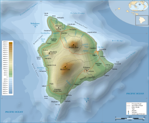
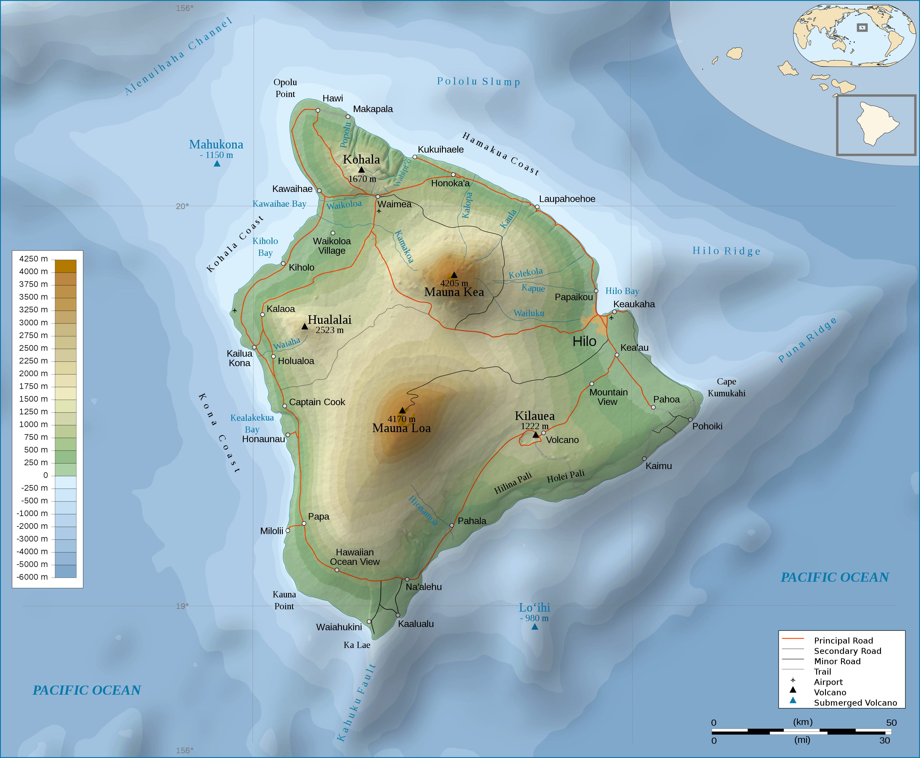
English: Topographic Map in english of the island of Hawaii. |
| Date | (UTC) |
| Source | |
| Auteur |
|
| Autres versions |
[]
|


Conditions d’utilisation
Ce fichier est disponible selon les termes de la licence Creative Commons Attribution – Partage dans les Mêmes Conditions 3.0 (non transposée).
- Vous êtes libre :
- de partager – de copier, distribuer et transmettre cette œuvre
- d’adapter – de modifier cette œuvre
- Sous les conditions suivantes :
- paternité – Vous devez donner les informations appropriées concernant l'auteur, fournir un lien vers la licence et indiquer si des modifications ont été faites. Vous pouvez faire cela par tout moyen raisonnable, mais en aucune façon suggérant que l’auteur vous soutient ou approuve l’utilisation que vous en faites.
- partage à l’identique – Si vous modifiez, transformez, ou vous basez sur cette œuvre, vous devez distribuer votre contribution sous la même licence ou une licence compatible avec celle de l’original.
Journal des téléversements d’origine
This image is a derivative work of the following images:
- File:Hawaii_Island_topographic_map-fr.svg licensed with Cc-by-sa-3.0,2.5,2.0,1.0, GFDL
- 2009-02-16T12:24:40Z Sémhur 3110x2563 (2213946 Bytes) Valid SVG
- 2008-05-07T17:31:00Z Sémhur 3110x2563 (2292418 Bytes) Route coupée trop courte, je rallonge.
- 2008-05-02T17:57:22Z Sémhur 3110x2563 (2290853 Bytes) Suppression d'une partie d'une route détruite par une coulée de lave
- 2008-05-01T10:37:28Z Sémhur 3110x2563 (2290359 Bytes) New version, with vectorized shaded relief
- 2008-04-29T18:35:04Z Sting 3110x2563 (1041004 Bytes) Slight correction
- 2008-04-29T18:11:00Z Sting 3110x2563 (1041493 Bytes) Added legend
- 2008-04-22T16:01:56Z Sémhur 3110x2563 (1036030 Bytes) Espacement de lettres (oubli)
- 2008-04-19T08:45:11Z Sémhur 3110x2563 (1034767 Bytes) Correction de l'altitude du Mauna Loa et espacement de lettres
- 2008-04-17T19:04:48Z Sémhur 3110x2563 (1019305 Bytes) Correction d'un problème avec le relief
- 2008-04-17T18:47:58Z Sémhur 3110x2563 (1019765 Bytes) == Description == {{Information |Description= {{en| Topographic Map in french of the island of [[:en:Hawaii (Island)|Hawaii]].}} {{fr| Carte topographique de l'île de [[:fr:Hawaii|Hawaii]].}} |Source=Travail personnel. {{clr
Téléversé avec derivativeFX
Historique du fichier
Cliquer sur une date et heure pour voir le fichier tel qu'il était à ce moment-là.
| Date et heure | Vignette | Dimensions | Utilisateur | Commentaire | |
|---|---|---|---|---|---|
| actuel | 4 mars 2009 à 00:56 | | 3 110 × 2 563 (2,12 Mio) | Kmusser | attempted legend fix |
| 4 mars 2009 à 00:54 |  | 3 110 × 2 563 (2,12 Mio) | Kmusser | attempted legend fix | |
| 4 mars 2009 à 00:49 |  | 3 110 × 2 563 (2,12 Mio) | Kmusser | legend fix | |
| 4 mars 2009 à 00:06 |  | 3 110 × 2 563 (2,12 Mio) | Kmusser | {{Information |Description={{Topographic Map in english of the island of Hawaii.}} |Source=*File:Hawaii_Island_topographic_map-fr.svg |Date=2009-03-03 22:04 (UTC) |Author=*File:Hawaii_Island_topographic_map-fr.svg: [[Us |
Utilisation du fichier
La page suivante utilise ce fichier :
Usage global du fichier
Les autres wikis suivants utilisent ce fichier :
- Utilisation sur af.wikipedia.org
- Utilisation sur cy.wikipedia.org
- Utilisation sur de.wikipedia.org
- Utilisation sur el.wikipedia.org
- Utilisation sur en.wikipedia.org
- Utilisation sur eo.wikipedia.org
- Utilisation sur fa.wikipedia.org
- Utilisation sur fy.wikipedia.org
- Utilisation sur hr.wikipedia.org
- Utilisation sur ja.wikipedia.org
- Utilisation sur ka.wikipedia.org
- Utilisation sur nl.wikipedia.org
- Utilisation sur pl.wikipedia.org
- Utilisation sur tr.wikipedia.org
- Utilisation sur zh.wikipedia.org