Fichier:Hurricane Floyd (1999).jpg
Pas de plus haute résolution disponible.
Hurricane_Floyd_(1999).jpg (720 × 540 pixels, taille du fichier : 255 kio, type MIME : image/jpeg)
Ce fichier et sa description proviennent de Wikimedia Commons.
.jpg?uselang=fr)
Description
| Description |
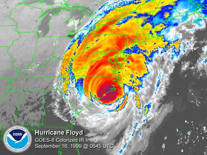
English: GOES 8 satellite colored infrared image of Hurricane Floyd making landfall at Cape Fear, North Carolina |
| Date | |
| Source | National Climatic Data Center |
| Auteur | National Oceanic and Atmospheric Administration |
Conditions d’utilisation
- The NOAA emblem is the property of the U.S. Government and a trademark of the United States Department of Commerce.
Cette image est dans le domaine public car son contenu provient de la
National Oceanic and Atmospheric Administration , réalisé par un employé dans le cadre de ses activités professionnelles.
|
Historique du fichier
Cliquer sur une date et heure pour voir le fichier tel qu'il était à ce moment-là.
| Date et heure | Vignette | Dimensions | Utilisateur | Commentaire | |
|---|---|---|---|---|---|
| actuel | 26 janvier 2006 à 23:06 | | 720 × 540 (255 kio) | Hurricanehink | From http://www1.ncdc.noaa.gov/pub/data/images/hurr-floyd-19990916-0645utc-g84kmir.jpg, this image shows Hurricane Floyd at its Cape Fear, North Carolina landfall on September 16, 1999. {{PD-USGov-NOAA}} {{NOAA logo}} [[Category:Atlantic hurricanes|Flo |
Utilisation du fichier
La page suivante utilise ce fichier :
Usage global du fichier
Les autres wikis suivants utilisent ce fichier :
- Utilisation sur en.wikipedia.org
- Utilisation sur es.wikipedia.org
.jpg)