Fichier:Hwy 48 Markham.png

Taille de cet aperçu : 800 × 600 pixels. Autres résolutions : 320 × 240 pixels | 640 × 480 pixels | 1 024 × 768 pixels | 1 280 × 960 pixels | 2 560 × 1 920 pixels | 3 456 × 2 592 pixels.
Fichier d’origine (3 456 × 2 592 pixels, taille du fichier : 11,94 Mio, type MIME : image/png)
Ce fichier et sa description proviennent de Wikimedia Commons.
Description
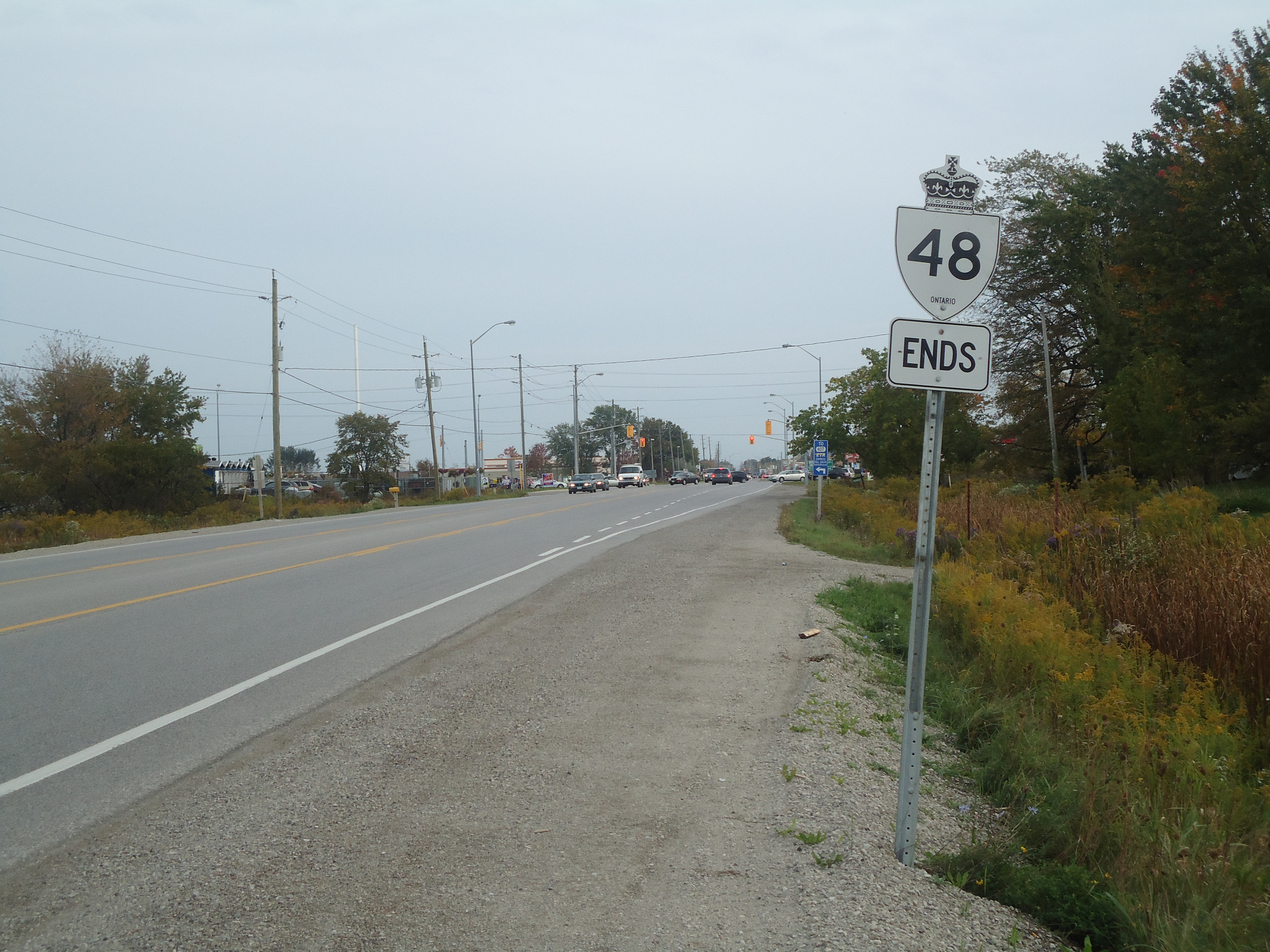
| Description | Highway 48 at its southern end at the rural-urban fringe of the Greater Toronto Area |
| Date | |
| Source | Travail personnel |
| Auteur | Floydian (talk) |
Conditions d’utilisation
Ce fichier est disponible selon les termes de la licence Creative Commons Attribution – Partage dans les Mêmes Conditions 3.0 (non transposée).
- Vous êtes libre :
- de partager – de copier, distribuer et transmettre cette œuvre
- d’adapter – de modifier cette œuvre
- Sous les conditions suivantes :
- paternité – Vous devez donner les informations appropriées concernant l'auteur, fournir un lien vers la licence et indiquer si des modifications ont été faites. Vous pouvez faire cela par tout moyen raisonnable, mais en aucune façon suggérant que l’auteur vous soutient ou approuve l’utilisation que vous en faites.
- partage à l’identique – Si vous modifiez, transformez, ou vous basez sur cette œuvre, vous devez distribuer votre contribution sous la même licence ou une licence compatible avec celle de l’original.
Historique du fichier
Cliquer sur une date et heure pour voir le fichier tel qu'il était à ce moment-là.
| Date et heure | Vignette | Dimensions | Utilisateur | Commentaire | |
|---|---|---|---|---|---|
| actuel | 3 octobre 2010 à 20:21 | | 3 456 × 2 592 (11,94 Mio) | Floydian | {{Information |Description=Highway 48 at its southern end at the rural-urban fringe of the Greater Toronto Area |Source={{own}} |Date=September 29, 2010 |Author=~~~ |Permission= |other_versions= }} Category:Roads in Ontario [[Category:Highway 48 (Onta |
Utilisation du fichier
La page suivante utilise ce fichier :