Fichier:Hyacinthe 1980 track.png

Taille de cet aperçu : 771 × 600 pixels. Autres résolutions : 309 × 240 pixels | 617 × 480 pixels | 987 × 768 pixels | 1 280 × 996 pixels | 2 000 × 1 556 pixels.
Fichier d’origine (2 000 × 1 556 pixels, taille du fichier : 341 kio, type MIME : image/png)
Ce fichier et sa description proviennent de Wikimedia Commons.
Description
| Description |
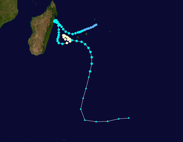
English: Cyclone Hyacinthe (1980) track. Uses the color scheme from the Saffir-Simpson Hurricane Scale. The points show the location of each storm at six-hour intervals. The colour represents the storm's maximum sustained wind speeds as classified in the Saffir-Simpson Hurricane Scale (see below), and the shape of the data points represent the nature of the storm.
Tropical depression (≤38 mph, ≤62 km/h)
Tropical storm (39–73 mph, 63–118 km/h)
Category 1 (74–95 mph, 119–153 km/h)
Category 2 (96–110 mph, 154–177 km/h)
Category 3 (111–129 mph, 178–208 km/h)
Category 4 (130–156 mph, 209–251 km/h)
Category 5 (≥157 mph, ≥252 km/h)
Unknown
Storm type |
| Date | January 15–January 31, 1980 |
| Source | Created using Wikipedia:WikiProject Tropical cyclones/Tracks. The background image was created by NASA. The tracking data is from the Joint Typhoon Warning Center's best track database |
| Auteur | Cyclonebiskit |
Conditions d’utilisation :
| Cette œuvre a été placée dans le domaine public par son auteur, Cyclonebiskit. Ceci s’applique dans le monde entier. Dans certains pays, ceci peut ne pas être possible ; dans ce cas : Cyclonebiskit accorde à toute personne le droit d’utiliser cette œuvre dans n’importe quel but, sans aucune condition, sauf celles requises par la loi. |
Historique du fichier
Cliquer sur une date et heure pour voir le fichier tel qu'il était à ce moment-là.
| Date et heure | Vignette | Dimensions | Utilisateur | Commentaire | |
|---|---|---|---|---|---|
| actuel | 13 avril 2013 à 17:55 | | 2 000 × 1 556 (341 kio) | Cyclonebiskit | == {{int:filedesc}} == {{Information |Description={{en|Track map of Tropical Cyclone Hyacinthe of the 1979-80 South-West Indian Ocean cyclone season. The points show the location of the storm at 6-hour intervals. The colour represents the storm's [[:w:... |
Utilisation du fichier
La page suivante utilise ce fichier :
Usage global du fichier
Les autres wikis suivants utilisent ce fichier :
- Utilisation sur en.wikipedia.org
- Utilisation sur ja.wikipedia.org