Fichier:John speed 1605 map oxford gropecunt.jpg

Taille de cet aperçu : 752 × 599 pixels. Autres résolutions : 301 × 240 pixels | 602 × 480 pixels | 827 × 659 pixels.
Fichier d’origine (827 × 659 pixels, taille du fichier : 236 kio, type MIME : image/jpeg)
Ce fichier et sa description proviennent de Wikimedia Commons.
| Description |
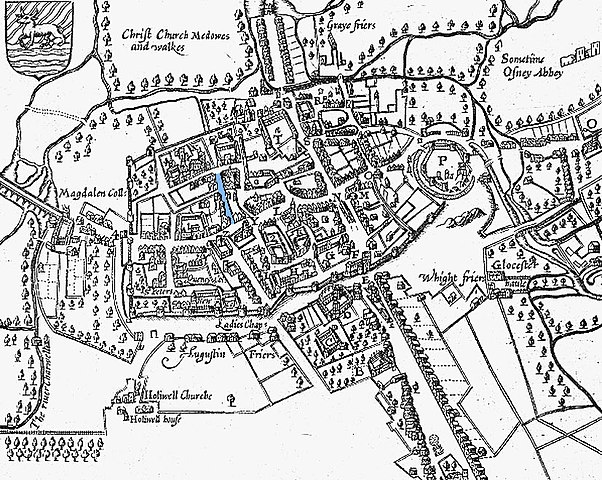
English: A 1605 map of Oxford, England, with north at the bottom. Gropecunt Lane is highlighted in blue on the left side of the image. |
||||
| Date | |||||
| Source | Derivative of File:John Speed's map of Oxford, 1605..jpg | ||||
| Auteur |
|
||||
| Autorisation (Réutilisation de ce fichier) |
|
||||
Historique du fichier
Cliquer sur une date et heure pour voir le fichier tel qu'il était à ce moment-là.
| Date et heure | Vignette | Dimensions | Utilisateur | Commentaire | |
|---|---|---|---|---|---|
| actuel | 22 décembre 2017 à 03:59 | | 827 × 659 (236 kio) | Nagualdesign | Updated. |
| 16 avril 2009 à 00:07 |  | 817 × 658 (234 kio) | Parrot of Doom | {{Information |Description={{en|1=A 1605 map of Oxford, England, with north at the bottom. Gropecunt Lane is highlighted in blue on the left side of the image.}} |Source=From an original upload at http://commons.wikimedia.org/wiki/File:John_Speed%27s_map |
Utilisation du fichier
Les 2 pages suivantes utilisent ce fichier :
Usage global du fichier
Les autres wikis suivants utilisent ce fichier :
- Utilisation sur en.wikipedia.org
- Utilisation sur es.wikipedia.org
- Utilisation sur it.wikipedia.org
- Utilisation sur ja.wikipedia.org
- Utilisation sur pt.wikipedia.org
- Utilisation sur www.wikidata.org