Fichier:Karnataka locator map.svg
Fichier d’origine (Fichier SVG, nominalement de 1 630 × 2 356 pixels, taille : 235 kio)

Ce fichier et sa description proviennent de Wikimedia Commons.

Titre
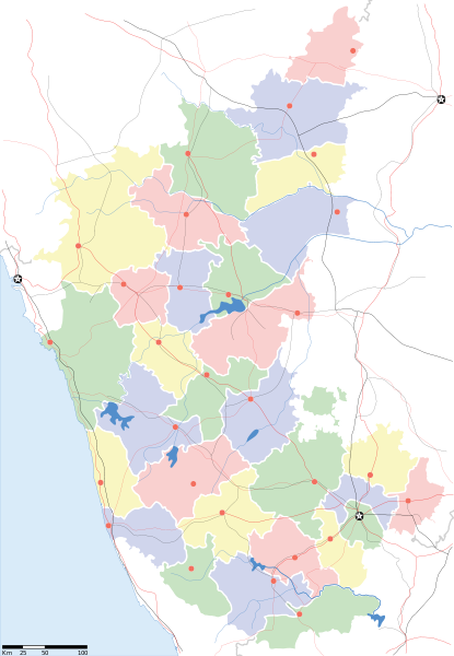
Karnataka locator Map
Description
Map of w:Karnataka with road and rail lines
Date
Source

Travail personnel
International Borders: University of Texas map library - India Political map 2001
Disputed Borders: University of Texas map library - China-India Borders - Eastern Sector 1988 & Western Sector 1988 - Kashmir Region 2004 - Kashmir Maps.
State and District boundaries: Census of India - 2001 Census State Maps - Survey of India Maps.
Other sources: US Army Map Service, Survey of India Map Explorer, Columbia University

Map specific sources: Karnataka Map, South Western Railway Map.
Créé par

যে নষ্ট

This Image was created by User:PlaneMad.
  • If you are using the image under the creative commons share alike license please credit the photo CC-by-sa PlaneMad/Wikimedia and include a link to this page. No explicit permission is needed from me, but id appreciate an email if my work has been of help to you.
  • If you dont want to release your work under a creative commons license, please mail me at arun.planemad@gmail.com or catch me at my Website to negotiate a custom license as per your needs.
Autorisation
(Réutilisation de ce fichier)
Moi, en tant que détenteur des droits d’auteur sur cette œuvre, je la publie sous la licence suivante :
w:fr:Creative Commons
paternité partage à l’identique
Ce fichier est disponible selon les termes de la licence Creative Commons Attribution – Partage dans les Mêmes Conditions 3.0 Non Transposé.
Vous êtes libre :
  • de partager – de copier, distribuer et transmettre cette œuvre
  • d’adapter – de modifier cette œuvre
Sous les conditions suivantes :
  • paternité – Vous devez donner les informations appropriées concernant l'auteur, fournir un lien vers la licence et indiquer si des modifications ont été faites. Vous pouvez faire cela par tout moyen raisonnable, mais en aucune façon suggérant que l’auteur vous soutient ou approuve l’utilisation que vous en faites.
  • partage à l’identique – Si vous modifiez, transformez ou vous basez sur cet élément, vous devez distribuer votre contribution sous une [[ccorg:share-your-work/licensing-considerations/compatible-licenses
|license identique ou compatible]] à celle de l’original.

The frontiers depicted on the Indian maps in Wikipedia are from a neutral point of view and may differ from official government maps of India, Pakistan and China. Please consult local laws governing publication of maps before usage.
 Données géotemporelles
Date représentée 2e moitié de XXe siècle et XXIe siècle
Géoréférencement Géoréférencer la carte dans Wikimaps Warper Si c'est inapproprié, définissez warp_status = skip pour masquer.
 Données d'archives
Notes Part of WikiProject India Maps


derivative works

Œuvres dérivées de ce fichier :  India Karnataka location map.svg

Légendes

Ajoutez en une ligne la description de ce que représente ce fichier

Éléments décrits dans ce fichier

dépeint

Historique du fichier

Cliquer sur une date et heure pour voir le fichier tel qu'il était à ce moment-là.

Date et heureVignetteDimensionsUtilisateurCommentaire
actuel20 novembre 2010 à 11:48Vignette pour la version du 20 novembre 2010 à 11:481 630 × 2 356 (235 kio)NayvikCreated 3 new districts Chikballapur district, Ramanagara district and Yadgir district
8 mai 2007 à 11:07Vignette pour la version du 8 mai 2007 à 11:071 630 × 2 356 (226 kio)Planemadchg color of chamarajanagar
6 mai 2007 à 14:55Vignette pour la version du 6 mai 2007 à 14:551 630 × 2 356 (226 kio)Planemad{{WikiProject_India_Maps |Title=Karnataka locator Map |Description=Map of w:Karnataka with road and rail lines |Source= [http://aquarium.lipetsk.ru/discovery/India2004/karnataka-map.jpg Karnataka Map], [http://www.indianrailways.gov.in/maps/st-wt-rly.

Aucune page n’utilise ce fichier.

Usage global du fichier

Les autres wikis suivants utilisent ce fichier :

Voir davantage sur l’utilisation globale de ce fichier.

Métadonnées