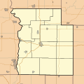
Fichier:Locator map of Parke County, Indiana.svg

Taille de cet aperçu PNG pour ce fichier SVG : 600 × 600 pixels. Autres résolutions : 240 × 240 pixels | 480 × 480 pixels | 768 × 768 pixels | 1 024 × 1 024 pixels | 2 048 × 2 048 pixels.
Fichier d’origine (Fichier SVG, nominalement de 768 × 768 pixels, taille : 115 kio)
Historique du fichier
Cliquer sur une date et heure pour voir le fichier tel qu'il était à ce moment-là.
| Date et heure | Vignette | Dimensions | Utilisateur | Commentaire | |
|---|---|---|---|---|---|
| actuel | 19 août 2010 à 17:21 |  | 768 × 768 (115 kio) | Omnedon | == {{int:filedesc}} == {{Information |Description={{en|This is a map of Parke County, Indiana, USA which includes township borders.}} |Source=My own work, using freely-available shape data from the United States Census Bureau with a custom-written MapScri |
Utilisation du fichier
La page suivante utilise ce fichier :
Usage global du fichier
Les autres wikis suivants utilisent ce fichier :
- Utilisation sur ar.wikipedia.org
- Utilisation sur azb.wikipedia.org
- Utilisation sur ceb.wikipedia.org
- Utilisation sur en.wikipedia.org
- Bloomingdale, Indiana
- Marshall, Indiana
- Rockville, Indiana
- Rosedale, Indiana
- Turkey Run State Park
- Bridgeton, Indiana
- Nyesville, Indiana
- Bellmore, Indiana
- Lusk Home and Mill Site
- Mansfield Roller Mill
- Mansfield, Indiana
- Big Rocky Fork Covered Bridge
- Conley's Ford Covered Bridge
- Bridgeton Covered Bridge
- Crooks Covered Bridge
- Beeson Covered Bridge
- Billie Creek Covered Bridge
- Bowsher Ford Covered Bridge
- Catlin Covered Bridge
- Cox Ford Covered Bridge
- Harry Evans Covered Bridge
- Jackson Covered Bridge
- Leatherwood Station Covered Bridge
- Arch in the Town of Marshall
- W. H. York Round Barn
- Lodi, Indiana
- Lyford, Indiana
- Module:Location map/data/USA Indiana Parke County/doc
- Annapolis, Indiana
- Bethany, Parke County, Indiana
- Byron, Parke County, Indiana
- Catlin, Indiana
- Coloma, Indiana
- Coxville, Indiana
Voir davantage sur l’utilisation globale de ce fichier.