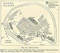
Fichier:Map Banaba Island 1936-fr.svg

Taille de cet aperçu PNG pour ce fichier SVG : 512 × 358 pixels. Autres résolutions : 320 × 224 pixels | 640 × 448 pixels | 1 024 × 716 pixels | 1 280 × 895 pixels | 2 560 × 1 790 pixels.
Fichier d’origine (Fichier SVG, nominalement de 512 × 358 pixels, taille : 252 kio)
Historique du fichier
Cliquer sur une date et heure pour voir le fichier tel qu'il était à ce moment-là.
| Date et heure | Vignette | Dimensions | Utilisateur | Commentaire | |
|---|---|---|---|---|---|
| actuel | 12 août 2018 à 21:21 |  | 512 × 358 (252 kio) | JoKalliauer | Resized image and added viewBox |
| 12 août 2018 à 11:52 |  | 1 052 × 744 (252 kio) | JoKalliauer | made file valid (had 766 errors) | |
| 11 novembre 2008 à 00:47 |  | 1 052 × 744 (569 kio) | Kimdime | ||
| 10 novembre 2008 à 21:32 |  | 1 052 × 744 (569 kio) | Kimdime | ||
| 10 novembre 2008 à 21:21 |  | 744 × 1 052 (525 kio) | Kimdime | ||
| 20 février 2007 à 01:58 | Aucune vignette | (897 kio) | Kimdime | {{Information |Description= Banaba Island, Kiribati in 1936 |Source=User:Indolences, utexas.edu |Date=2007 |Author=User:Kimdime69 translation and little modifications of a map drawn by User:Indolences |Permission= {{PD-self}} |other_versions= | |
| 20 février 2007 à 01:51 | Aucune vignette | (1,93 Mio) | Kimdime | {{Information |Description= Banaba Island, Kiribati in 1936 |Source=User:Indolences, utexas.edu |Date=2007 |Author=User:Kimdime69 translation and little modifications of a map drawn by User:Indolences |Permission= {{PD-self}} |other_versions= |
Utilisation du fichier
La page suivante utilise ce fichier :


