Fichier:Map Stuttgart 21 outer.png
Taille de cet aperçu : 649 × 600 pixels. Autres résolutions : 260 × 240 pixels | 519 × 480 pixels | 831 × 768 pixels | 1 040 × 961 pixels.
Fichier d’origine (1 040 × 961 pixels, taille du fichier : 495 kio, type MIME : image/png)
Ce fichier et sa description proviennent de Wikimedia Commons.
Description
| Description |
|
| Date | |
| Source | conversion of Image:Map Stuttgart 21 outer.svg to PNG format |
| Auteur | K. Jähne |

|
Une version vectorielle de cette image existe, dans le format « SVG ». Si elle n’est pas inférieure, elle devrait être utilisée à la place de la présente version pour des affichages en plus grandes dimensions ou nécessitant une meilleure résolution.
File:Map Stuttgart 21 outer.png → File:Map Stuttgart 21 outer.svg
Pour plus d’informations sur les images vectorielles, consultez la page de transition de Commons vers le format SVG. Voir aussi les informations à propos de la manière dont le logiciel MediaWiki gère les images au format SVG. |
 |
Conditions d’utilisation
| Cette œuvre a été placée dans le domaine public par son auteur, kjunix. Ceci s’applique dans le monde entier. Dans certains pays, ceci peut ne pas être possible ; dans ce cas : |
Historique du fichier
Cliquer sur une date et heure pour voir le fichier tel qu'il était à ce moment-là.
| Date et heure | Vignette | Dimensions | Utilisateur | Commentaire | |
|---|---|---|---|---|---|
| actuel | 19 octobre 2010 à 22:31 | | 1 040 × 961 (495 kio) | Kjunix | adding freight train connection near Wendlingen |
| 1 mai 2008 à 17:05 |  | 1 040 × 961 (493 kio) | Kjunix | fix | |
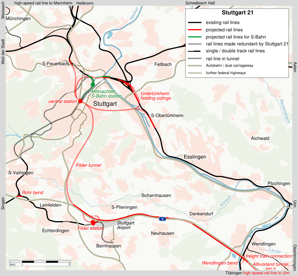
| 20 avril 2008 à 23:37 |  | 1 040 × 961 (493 kio) | Kjunix | == Description == {{Information| |Description = *{{de|Karte von Stuttgart 21 (englische Beschriftung).}} *{{en|map of project Stuttgart 21 (english labeling).}} |Source = translation of [[:Karte Stuttgart 21 ausse |
Utilisation du fichier
Les 2 pages suivantes utilisent ce fichier :
Usage global du fichier
Les autres wikis suivants utilisent ce fichier :
- Utilisation sur de.wikipedia.org
- Utilisation sur en.wikipedia.org
- Utilisation sur hu.wikipedia.org