Fichier:NPS sleeping-bear-dunes-map.jpg

Taille de cet aperçu : 332 × 599 pixels. Autres résolutions : 133 × 240 pixels | 266 × 480 pixels | 425 × 768 pixels | 567 × 1 024 pixels | 1 712 × 3 089 pixels.
Fichier d’origine (1 712 × 3 089 pixels, taille du fichier : 690 kio, type MIME : image/jpeg)
Ce fichier et sa description proviennent de Wikimedia Commons.
Description
| Description |
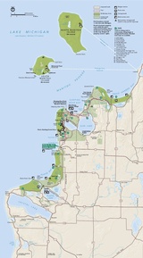
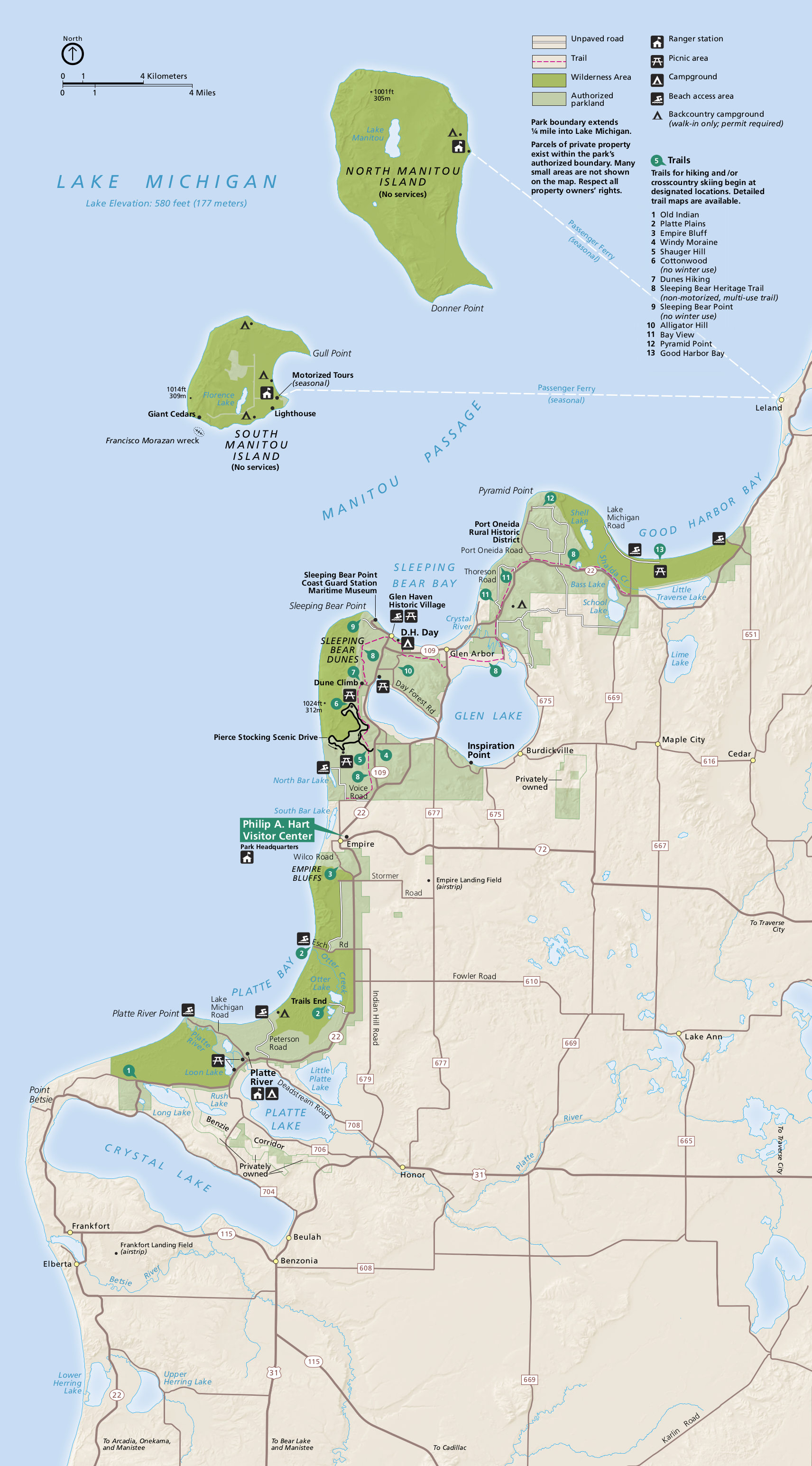
English: Main Sleeping Bear Dunes map which shows the points of interest on the mainland as well as the Manitou Islands. |
| Date | |
| Source | U.S. National Park Service (http://npmaps.com/wp-content/uploads/sleeping-bear-dunes-map.jpg) |
| Auteur | U.S. National Park Service, restoration/cleanup by Matt Holly |
| Autres versions |
 |
Conditions d’utilisation
| Cette image ou ce document multimédia contient des éléments basés sur une œuvre d'un employé du National Park Service, créé dans le cadre des tâches officielles de cette personne. En tant qu'œuvre du Gouvernement fédéral des États-Unis, une telle œuvre se trouve dans le domaine public aux États-Unis. Voir NPS website et NPS copyright policy pour plus d'informations. |
Historique du fichier
Cliquer sur une date et heure pour voir le fichier tel qu'il était à ce moment-là.
| Date et heure | Vignette | Dimensions | Utilisateur | Commentaire | |
|---|---|---|---|---|---|
| actuel | 17 mai 2017 à 11:33 | | 1 712 × 3 089 (690 kio) | RKBot | =={{int:filedesc}}== {{Information |description= {{en|1=Main Sleeping Bear Dunes map which shows the points of interest on the mainland as well as the Manitou Islands.}} |date= 2016-03-19 |source= U.S. National Park Service (http://npmaps.com/wp-conten... |
Utilisation du fichier
La page suivante utilise ce fichier :
Usage global du fichier
Les autres wikis suivants utilisent ce fichier :
- Utilisation sur www.wikidata.org