Fichier:Nilgiri Hills Bahn.jpg

Taille de cet aperçu : 800 × 456 pixels. Autres résolutions : 320 × 182 pixels | 640 × 365 pixels | 911 × 519 pixels.
Fichier d’origine (911 × 519 pixels, taille du fichier : 191 kio, type MIME : image/jpeg)
Ce fichier et sa description proviennent de Wikimedia Commons.
source: http://commons.wikimedia.org/wiki/Image:Nilgiri_Hills_Topo.jpg
Description
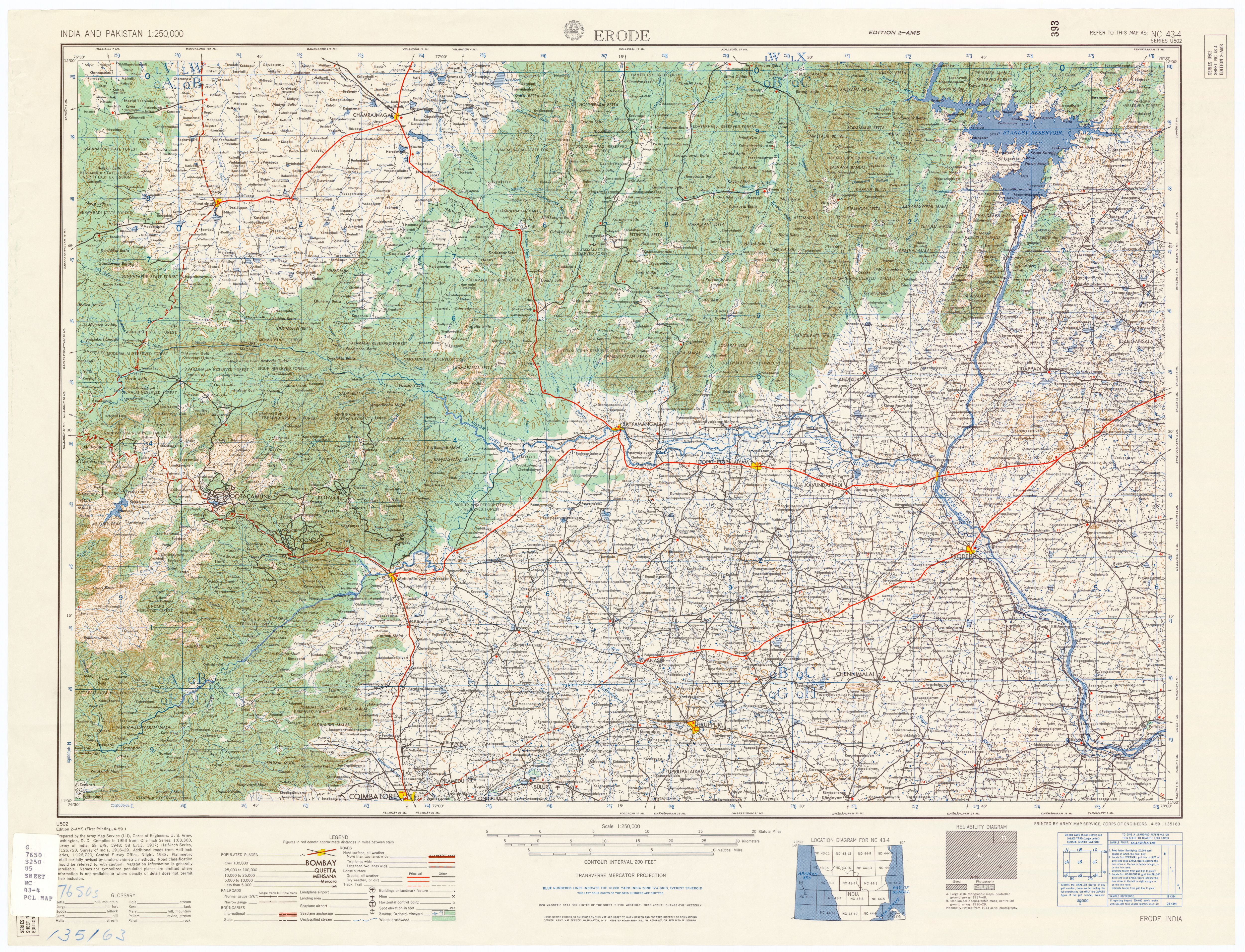
Description: Topo Map, Nilgiri Hills, Tamil Nadu, India.
Source: U.S. Army Topology Command, Erode India, sheet NC 43-4
Date: 1953
Author: U.S. Army Map Service, cropped by Marcus 9/3/2007
Permission: Public Domain
Other versions: Erode India, sheet NC 43-4
Conditions d’utilisation
Cette image est une œuvre d'un soldat ou d'un employé de l'U.S. Army, réalisée dans le cadre de ses activités professionnelles. En tant qu'œuvre du gouvernement fédéral des États-Unis d'Amérique, cette image fait partie du domaine public.
|
 |
Historique du fichier
Cliquer sur une date et heure pour voir le fichier tel qu'il était à ce moment-là.
| Date et heure | Vignette | Dimensions | Utilisateur | Commentaire | |
|---|---|---|---|---|---|
| actuel | 4 avril 2008 à 17:27 | | 911 × 519 (191 kio) | Ori~ | {{Information |Description= |Source= |Date= |Author= |Permission= |other_versions= }} |
| 2 avril 2008 à 16:25 |  | 1 504 × 1 900 (1 010 kio) | Ori~ | {{Information |Description= |Source= |Date= |Author= |Permission= |other_versions= }} | |
| 2 avril 2008 à 16:14 |  | 1 504 × 1 900 (1 Mio) | Ori~ | source: http://commons.wikimedia.org/wiki/Image:Nilgiri_Hills_Topo.jpg == Summary == Description: Topo Map, Nilgiri Hills, Tamil Nadu, India. Source: U.S. Army Topology Command, Erode India, sheet NC 43-4 Date: 1953 Author: U.S. Army Map Service, c |
Utilisation du fichier
La page suivante utilise ce fichier :
Usage global du fichier
Les autres wikis suivants utilisent ce fichier :
- Utilisation sur ru.wikipedia.org
- Utilisation sur www.wikidata.org