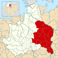
Fichier:Ostfalia locator map (1000).svg

Taille de cet aperçu PNG pour ce fichier SVG : 600 × 600 pixels. Autres résolutions : 240 × 240 pixels | 480 × 480 pixels | 768 × 768 pixels | 1 024 × 1 024 pixels | 2 048 × 2 048 pixels | 1 500 × 1 500 pixels.
Fichier d’origine (Fichier SVG, nominalement de 1 500 × 1 500 pixels, taille : 5,62 Mio)
Historique du fichier
Cliquer sur une date et heure pour voir le fichier tel qu'il était à ce moment-là.
| Date et heure | Vignette | Dimensions | Utilisateur | Commentaire | |
|---|---|---|---|---|---|
| actuel | 18 mai 2016 à 02:50 |  | 1 500 × 1 500 (5,62 Mio) | Alphathon | Minor correction |
| 18 mai 2016 à 02:44 |  | 1 500 × 1 500 (5,62 Mio) | Alphathon | == {{int:filedesc}} == {{Inkscape}} {{Information |Description={{en|A map of the en:Eastphalia (German: ''Ostfalen'') around the year 1000. The map is derived from a vectorised version of one found in Professor G. Droysens Allgemeiner Histori... |
Utilisation du fichier
La page suivante utilise ce fichier :
Usage global du fichier
Les autres wikis suivants utilisent ce fichier :
- Utilisation sur ar.wikipedia.org
- Utilisation sur da.wikipedia.org
- Utilisation sur en.wikipedia.org
- Utilisation sur es.wikipedia.org
- Utilisation sur fy.wikipedia.org
- Utilisation sur he.wikipedia.org
- Utilisation sur id.wikipedia.org
- Utilisation sur no.wikipedia.org


