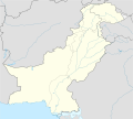
Fichier:Pakistan location map.svg

Taille de cet aperçu PNG pour ce fichier SVG : 750 × 599 pixels. Autres résolutions : 300 × 240 pixels | 601 × 480 pixels | 961 × 768 pixels | 1 280 × 1 023 pixels | 2 560 × 2 046 pixels | 2 365 × 1 890 pixels.
Fichier d’origine (Fichier SVG, nominalement de 2 365 × 1 890 pixels, taille : 461 kio)
Historique du fichier
Cliquer sur une date et heure pour voir le fichier tel qu'il était à ce moment-là.
| Date et heure | Vignette | Dimensions | Utilisateur | Commentaire | |
|---|---|---|---|---|---|
| actuel | 5 novembre 2020 à 17:00 |  | 2 365 × 1 890 (461 kio) | NordNordWest | small correction |
| 1 juin 2020 à 09:42 |  | 2 365 × 1 890 (459 kio) | NordNordWest | c | |
| 9 juin 2018 à 13:06 |  | 2 365 × 1 890 (771 kio) | Mar4d | The map is correct as it shows the de facto position | |
| 24 avril 2017 à 05:34 |  | 2 365 × 1 890 (462 kio) | फ़िलप्रो | Siachen Glacier under Indian control | |
| 31 octobre 2008 à 14:36 |  | 2 365 × 1 890 (771 kio) | NordNordWest | Kashmir completely | |
| 28 octobre 2008 à 19:34 |  | 2 105 × 1 890 (653 kio) | NordNordWest | ||
| 27 septembre 2008 à 22:20 |  | 2 105 × 1 890 (650 kio) | NordNordWest | {{Information |Description= {{de|Positionskarte von Pakistan}} Quadratische Plattkarte, N-S-Streckung 115 %. Geographische Begrenzung der Karte: * N: 37.3° N * S: 23.4° N * W: 60.5° O * O: 78.3° O {{en|Location map of [[:en:Pakistan|P |
Utilisation du fichier
La page suivante utilise ce fichier :
Usage global du fichier
Les autres wikis suivants utilisent ce fichier :
- Utilisation sur af.wikipedia.org
- Utilisation sur als.wikipedia.org
- Utilisation sur ar.wikipedia.org
- قالب:خريطة مواقع باكستان
- موجة الحر الباكستانية 2015
- بوابة:التراث العالمي
- قالب:خريطة مواقع التراث العالمي في باكستان
- بوابة:التراث العالمي/خريطة مختارة
- وحدة:Location map/data/Pakistan
- وحدة:Location map/data/Pakistan/شرح
- تفجير باراتشينار 2017
- تفجيرات باكستان (يونيو 2017)
- قائمة العواصم في باكستان
- تفجير بيشاور 2018
- مذبحة غلغت 1988
- Utilisation sur ast.wikipedia.org
- Islamabad
- Karachi
- Lahore
- K2
- Nanga Parbat
- Gasherbrum I
- Broad Peak
- Gasherbrum II
- Pasu de Khunjerab
- Chitral
- Badshahi Masjid
- Faisalabad
- Gujranwala
- Sialkot
- Módulu:Mapa de llocalización/datos/Paquistán
- Módulu:Mapa de llocalización/datos/Paquistán/usu
- Universidá Aga Khan
- Autoridá d'aviación civil de Paquistán
- Puertu Qasim
- Puertu de Gwadar
- Puertu de Karachi
Voir davantage sur l’utilisation globale de ce fichier.


