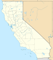
Fichier:Relief map of Northern California.png
Relief_map_of_Northern_California.png (654 × 489 pixels, taille du fichier : 454 kio, type MIME : image/png)
Historique du fichier
Cliquer sur une date et heure pour voir le fichier tel qu'il était à ce moment-là.
| Date et heure | Vignette | Dimensions | Utilisateur | Commentaire | |
|---|---|---|---|---|---|
| actuel | 23 juin 2019 à 19:09 |  | 654 × 489 (454 kio) | RaviC | File:Relief map of California.png cropped 4 % horizontally, 37 % vertically using CropTool with precise mode. |
Utilisation du fichier
La page suivante utilise ce fichier :
Usage global du fichier
Les autres wikis suivants utilisent ce fichier :
- Utilisation sur azb.wikipedia.org
- Utilisation sur en.wikipedia.org
- Sausalito, California
- Fort Bragg, California
- Foster City, California
- Three Rivers, California
- Yolo Bypass
- City of Ten Thousand Buddhas
- Mount Saint Helena
- Anthony Peak
- Patchen Pass
- Module:Location map/data/USA California Northern
- Module:Location map/data/USA California Northern/doc
- Wikipedia:Graphics Lab/Map workshop/Archive/Jun 2019
- User:RogueScholar/sandbox 1
- The Inkwells
- Atherwood
- Utilisation sur hi.wikipedia.org
- Utilisation sur ja.wikipedia.org
- Utilisation sur ml.wikipedia.org
- Utilisation sur ru.wikipedia.org
- Utilisation sur simple.wikipedia.org
- Utilisation sur si.wikipedia.org
- Utilisation sur uz.wikipedia.org


