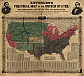
Fichier:Reynolds's Political Map of the United States 1856.jpg

Taille de cet aperçu : 661 × 600 pixels. Autres résolutions : 265 × 240 pixels | 529 × 480 pixels | 846 × 768 pixels | 1 128 × 1 024 pixels | 2 257 × 2 048 pixels | 7 813 × 7 090 pixels.
Fichier d’origine (7 813 × 7 090 pixels, taille du fichier : 19,76 Mio, type MIME : image/jpeg)
Historique du fichier
Cliquer sur une date et heure pour voir le fichier tel qu'il était à ce moment-là.
| Date et heure | Vignette | Dimensions | Utilisateur | Commentaire | |
|---|---|---|---|---|---|
| actuel | 16 août 2023 à 19:29 |  | 7 813 × 7 090 (19,76 Mio) | Jengod | Autotune so brighter and easier to read |
| 22 avril 2016 à 08:28 |  | 7 813 × 7 090 (35,27 Mio) | Khamar | Original improved in Adobe Photoshop by removing white strip through center where left and right sides of map join, removing some dark and white stripes from image, and nudging some of the text and lines back into alignment preserving as much of the ma... | |
| 17 décembre 2012 à 02:40 |  | 7 828 × 7 090 (16,56 Mio) | T3hBra1nWa5her | Higher resolution version from the [http://memory.loc.gov/cgi-bin/query/h?ammem/gmd:@field(NUMBER+@band(g3701e+ct000604)) Library of Congress Geography and Map Division Washington]. | |
| 1 août 2008 à 14:15 |  | 2 000 × 1 736 (709 kio) | Bdamokos | {{Information |Description={{en|US map 1856 shows free and slave states and populations; this is "Reynolds's Political Map of the United States" (1856) from Library of Congress collection[http://lcweb2.loc.gov/ammem/aaohtml/exhibit/aopart3b.html] [[:en |
Utilisation du fichier
Les 7 pages suivantes utilisent ce fichier :
Usage global du fichier
Les autres wikis suivants utilisent ce fichier :
- Utilisation sur ar.wikipedia.org
- Utilisation sur ca.wikipedia.org
- Utilisation sur de.wikipedia.org
- Utilisation sur en.wikipedia.org
- Utilisation sur en.wikiquote.org
- Utilisation sur es.wikipedia.org
- Utilisation sur fa.wikipedia.org
- Utilisation sur fi.wikipedia.org
- Utilisation sur he.wikipedia.org
- Utilisation sur hu.wikipedia.org
- Utilisation sur id.wikipedia.org
- Utilisation sur it.wikipedia.org
- Utilisation sur ja.wikipedia.org
- Utilisation sur ko.wikipedia.org
- Utilisation sur no.wikipedia.org
- Utilisation sur pl.wikipedia.org
- Utilisation sur pt.wikipedia.org
- Utilisation sur ro.wikipedia.org
- Utilisation sur ru.wikipedia.org
- Utilisation sur sh.wikipedia.org
- Utilisation sur simple.wikipedia.org
- Utilisation sur uk.wikipedia.org
- Utilisation sur zh.wikipedia.org