Fichier:RuruferwegMap.jpg
Taille de cet aperçu : 800 × 600 pixels. Autres résolutions : 320 × 240 pixels | 640 × 480 pixels | 1 024 × 768 pixels | 1 280 × 960 pixels | 2 048 × 1 536 pixels.
Fichier d’origine (2 048 × 1 536 pixels, taille du fichier : 998 kio, type MIME : image/jpeg)
Ce fichier et sa description proviennent de Wikimedia Commons.
Description
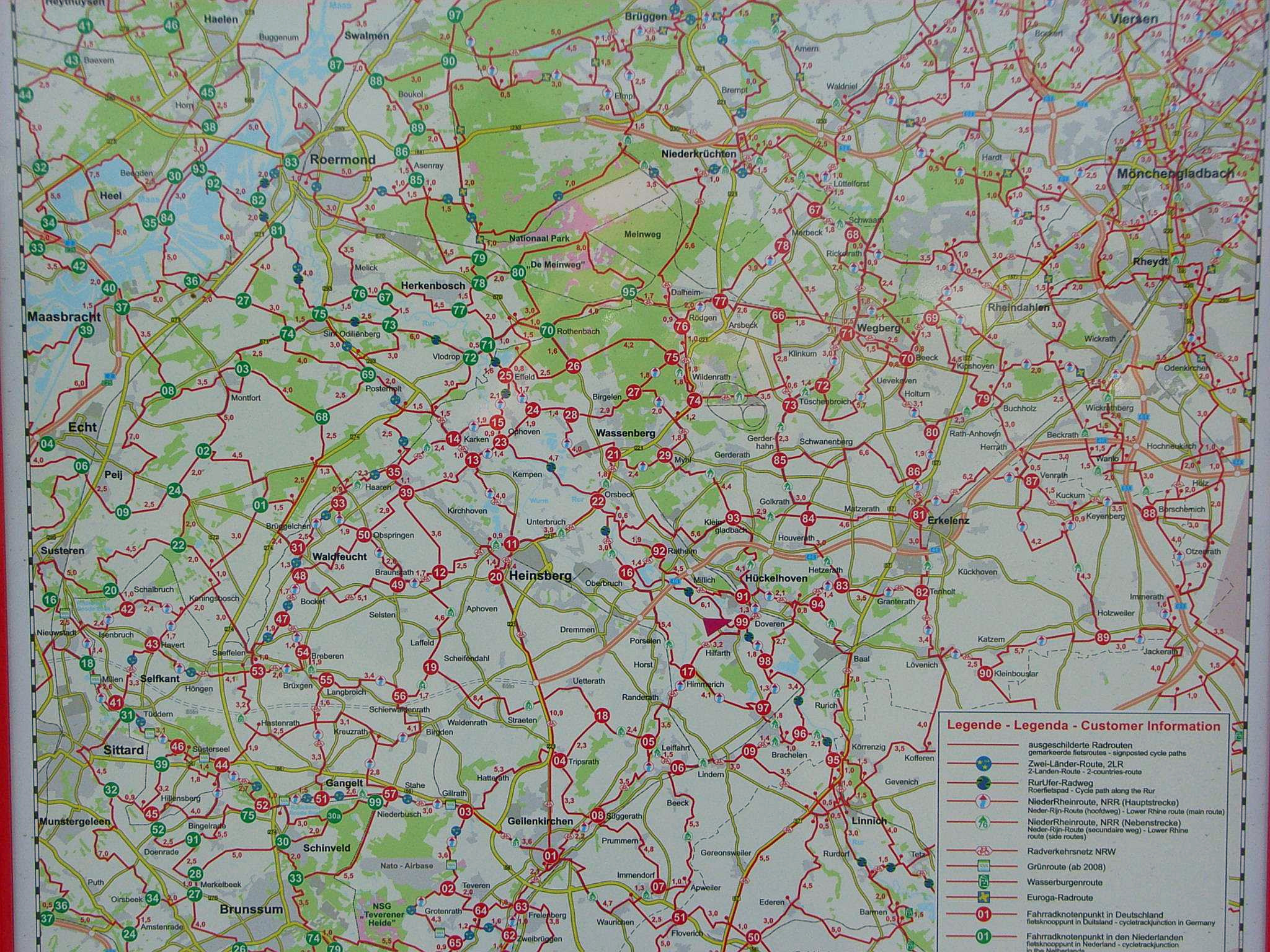
| Description | Fahrradkarte Kreis Heinsberg und Nachbarkreise |
| Date | |
| Source | öffentliche dauerhafte Schautafel, Linnich |
| Auteur |
Conditions d’utilisation

|
Le détenteur des droits d’auteur de ce fichier autorise n’importe qui à l’utiliser pour n’importe quelle utilisation, pourvu que le détenteur des droits d’auteur soit correctement attribué. La redistribution, les œuvres dérivées, l’utilisation commerciale et toutes les autres utilisations sont autorisées. |
|
|
Historique du fichier
Cliquer sur une date et heure pour voir le fichier tel qu'il était à ce moment-là.
| Date et heure | Vignette | Dimensions | Utilisateur | Commentaire | |
|---|---|---|---|---|---|
| actuel | 12 juin 2021 à 11:41 | | 2 048 × 1 536 (998 kio) | Noxbis | White balance |
| 11 avril 2007 à 19:11 |  | 2 048 × 1 536 (483 kio) | Bodoklecksel | == Summary == {{Information |Description=Fahrradkarte Kreis Heinsberg und Nachbarkreise|Source=öffentliche dauerhafte Schautafel, Linnich |Date= 2007|Author= |Permission= |other_versions= }} == Licensing == {{Attribution}} |
Utilisation du fichier
La page suivante utilise ce fichier :
Usage global du fichier
Les autres wikis suivants utilisent ce fichier :
- Utilisation sur en.wikipedia.org