Fichier:Rustamid territory 9th century.png

Taille de cet aperçu : 800 × 486 pixels. Autres résolutions : 320 × 195 pixels | 640 × 389 pixels | 1 024 × 622 pixels | 1 520 × 924 pixels.
Fichier d’origine (1 520 × 924 pixels, taille du fichier : 912 kio, type MIME : image/png)
Ce fichier et sa description proviennent de Wikimedia Commons.
Description
| Description |
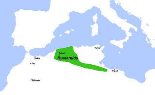
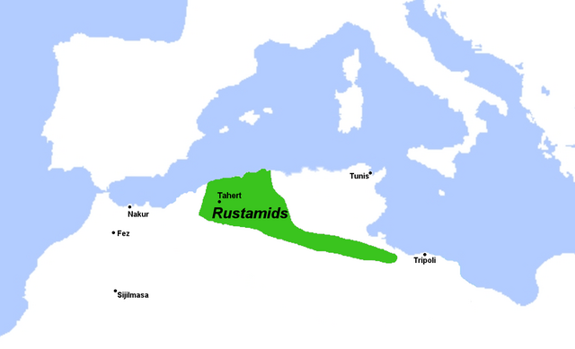
English: Map of approximate Rustamid territory in the 9th century.
Sources:
|
| Date | |
| Source | Travail personnel |
| Auteur | R Prazeres |
Conditions d’utilisation
Moi, en tant que détenteur des droits d’auteur sur cette œuvre, je la publie sous la licence suivante :
Ce fichier est sous la licence Creative Commons Attribution – Partage dans les Mêmes Conditions 4.0 International.
- Vous êtes libre :
- de partager – de copier, distribuer et transmettre cette œuvre
- d’adapter – de modifier cette œuvre
- Sous les conditions suivantes :
- paternité – Vous devez donner les informations appropriées concernant l'auteur, fournir un lien vers la licence et indiquer si des modifications ont été faites. Vous pouvez faire cela par tout moyen raisonnable, mais en aucune façon suggérant que l’auteur vous soutient ou approuve l’utilisation que vous en faites.
- partage à l’identique – Si vous modifiez, transformez, ou vous basez sur cette œuvre, vous devez distribuer votre contribution sous la même licence ou une licence compatible avec celle de l’original.
Historique du fichier
Cliquer sur une date et heure pour voir le fichier tel qu'il était à ce moment-là.
| Date et heure | Vignette | Dimensions | Utilisateur | Commentaire | |
|---|---|---|---|---|---|
| actuel | 28 octobre 2022 à 01:14 | | 1 520 × 924 (912 kio) | M.Bitton | Reverted to version as of 07:51, 24 April 2022 (UTC): I suggest you read the cited sources |
| 27 octobre 2022 à 23:44 |  | 1 280 × 940 (131 kio) | Takiva | fix | |
| 24 avril 2022 à 09:51 |  | 1 520 × 924 (912 kio) | R Prazeres | Uploaded own work with UploadWizard |
Utilisation du fichier
La page suivante utilise ce fichier :
Usage global du fichier
Les autres wikis suivants utilisent ce fichier :
- Utilisation sur ar.wikipedia.org
- Utilisation sur bn.wikipedia.org
- Utilisation sur de.wikipedia.org
- Utilisation sur en.wikipedia.org
- Utilisation sur fa.wikipedia.org
- Utilisation sur fi.wikipedia.org
- Utilisation sur id.wikipedia.org
- Utilisation sur ko.wikipedia.org
- Utilisation sur ms.wikipedia.org
- Utilisation sur nl.wikipedia.org
- Utilisation sur simple.wikipedia.org
- Utilisation sur ur.wikipedia.org