Fichier:Satellite image of 2015 Southeast Asian haze - 20150924.jpg

Taille de cet aperçu : 800 × 533 pixels. Autres résolutions : 320 × 213 pixels | 640 × 427 pixels | 1 024 × 683 pixels | 1 280 × 853 pixels | 2 560 × 1 707 pixels | 7 200 × 4 800 pixels.
Fichier d’origine (7 200 × 4 800 pixels, taille du fichier : 6,15 Mio, type MIME : image/jpeg)
Ce fichier et sa description proviennent de Wikimedia Commons.
Description
| Description |
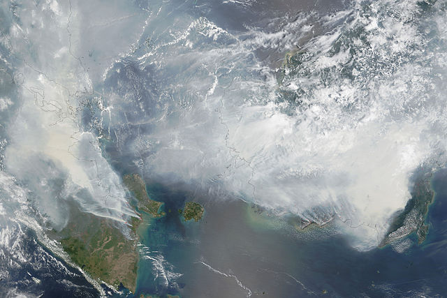
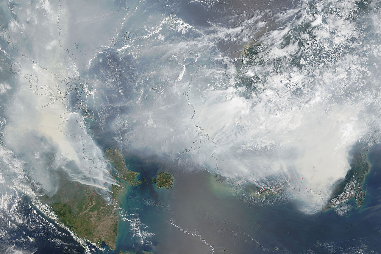
English: As seen in this September 24 image from the Moderate Resolution Imaging Spectroradiometer (MODIS) on NASA’s Terra satellite, Red outlines indicate hot spots where the sensor detected unusually warm surface temperatures associated with fires. Thick gray smoke hovers over both islands and has triggered air quality alerts and health warnings in Indonesia and neighboring countries. Visibility has plummeted.
العربية: صورةٌ عبرَ الأقمار الصناعيّة التابعة لوكالة ناسا وتُظهر مدى الضباب الذي ضربَ جنوب شرق آسيا في 24 أيلول/سبتمبر 2015
Caption by Adam Voiland. |
| Date | |
| Source | http://earthobservatory.nasa.gov/IOTD/view.php?id=86681 |
| Auteur | NASA image by Adam Voiland (NASA Earth Observatory) and Jeff Schmaltz (LANCE MODIS Rapid Response) |
Conditions d’utilisation
| Ce fichier provient de la NASA. Sauf exception, les documents créés par la NASA ne sont pas soumis à copyright. Pour plus d'informations, voir la politique de copyright de la NASA. | ||
 |
Attention :
|
Historique du fichier
Cliquer sur une date et heure pour voir le fichier tel qu'il était à ce moment-là.
| Date et heure | Vignette | Dimensions | Utilisateur | Commentaire | |
|---|---|---|---|---|---|
| actuel | 28 septembre 2015 à 11:19 | | 7 200 × 4 800 (6,15 Mio) | RectorRocks | {{subst:Upload marker added by en.wp UW}} {{Information |Description = {{en|As seen in this September 24 image from the Moderate Resolution Imaging Spectroradiometer (MODIS) on NASA’s... |
Utilisation du fichier
La page suivante utilise ce fichier :
Usage global du fichier
Les autres wikis suivants utilisent ce fichier :
- Utilisation sur ar.wikipedia.org
- Utilisation sur bg.wikipedia.org
- Utilisation sur bg.wikinews.org
- Utilisation sur en.wikipedia.org
- Utilisation sur es.wikipedia.org
- Utilisation sur ha.wikipedia.org
- Utilisation sur id.wikipedia.org
- Utilisation sur ms.wikipedia.org
- Utilisation sur no.wikipedia.org
- Utilisation sur zh.wikipedia.org