Fichier:Shetlandinseln (Landsat).jpg

Fichier d’origine (2 986 × 2 986 pixels, taille du fichier : 7,35 Mio, type MIME : image/jpeg)
Ce fichier et sa description proviennent de Wikimedia Commons.
.jpg?uselang=fr)
- Svenska: Satellitbild av Shetlandsöarna
- English: Satellite image of the Shetland Islands.
| Ce fichier provient de la NASA. Sauf exception, les documents créés par la NASA ne sont pas soumis à copyright. Pour plus d'informations, voir la politique de copyright de la NASA. | ||
 |
Attention :
|
From the German Wikipedia
Earth As Art: Shetlandinseln (Landsat)
von: http://landsat.gsfc.nasa.gov/earthasart/shetland.html
Public Domain, Image courtesy of NASA Landsat Project Science Office and USGS EROS Data Center
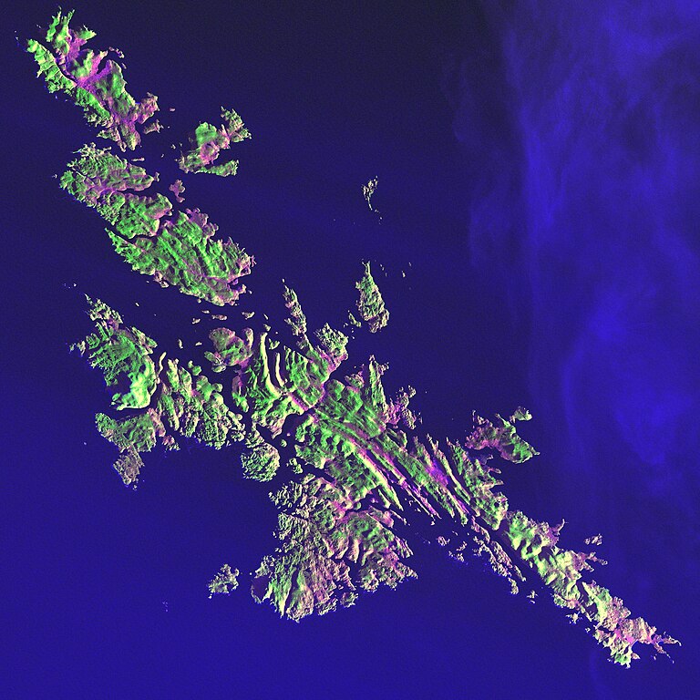
Shetland Islands Image taken 12/11/2001 by Landsat 7
Like a many-faceted jewel fashioned in an indigo setting, the Shetland Islands lie 210 kilometers north of the Scottish mainland in the North Atlantic Ocean. Despite their 60 degree north latitude, the Shetlands enjoy a relatively temperate climate thanks to the warming influence of the Gulf Stream.
This image can be found on Landsat 7 Path 205 Row 18, center: 60.1 N, 1.2 W.
Bild-Versionen
Legende: (Aktuell) = dies ist das aktuelle Bild, (Löschen) = lösche diese alte Version, (Zurücksetzen) = verwende wieder diese alte Version.
- (Löschen) (Aktuell) 20:40, 30. Mär 2004 . . Srbauer (23305 Byte) (Earth As Art: Shetlandinseln (Landsat))
Historique du fichier
Cliquer sur une date et heure pour voir le fichier tel qu'il était à ce moment-là.
| Date et heure | Vignette | Dimensions | Utilisateur | Commentaire | |
|---|---|---|---|---|---|
| actuel | 10 février 2010 à 02:01 | | 2 986 × 2 986 (7,35 Mio) | Scewing | Higher Resolution |
| 20 juin 2005 à 00:57 |  | 287 × 287 (23 kio) | Laserpekare~commonswiki |
Utilisation du fichier
La page suivante utilise ce fichier :
Usage global du fichier
Les autres wikis suivants utilisent ce fichier :
- Utilisation sur af.wikipedia.org
- Utilisation sur da.wikipedia.org
- Utilisation sur de.wikipedia.org
- Utilisation sur fo.wikipedia.org
- Utilisation sur la.wikipedia.org
- Utilisation sur pl.wikipedia.org
- Utilisation sur pl.wiktionary.org
.jpg)