Fichier:Sonoma Lake aerial view.jpg
Taille de cet aperçu : 800 × 534 pixels. Autres résolutions : 320 × 214 pixels | 640 × 427 pixels | 1 024 × 683 pixels | 1 500 × 1 001 pixels.
Fichier d’origine (1 500 × 1 001 pixels, taille du fichier : 542 kio, type MIME : image/jpeg)
Ce fichier et sa description proviennent de Wikimedia Commons.
| Description |
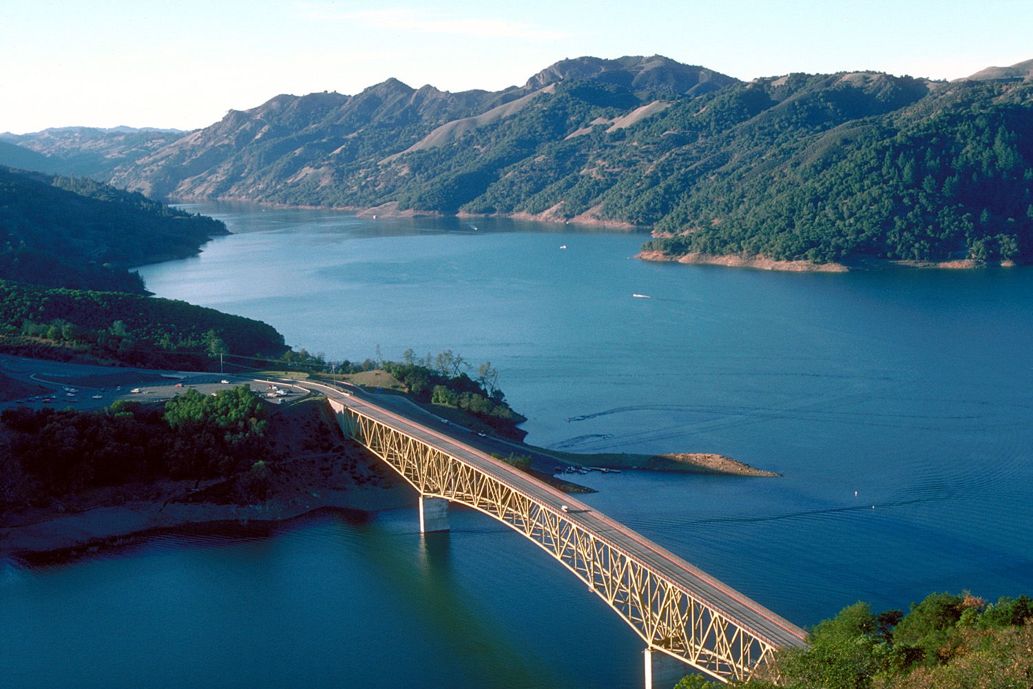
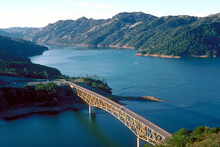
English: Aerial view of Lake Sonoma on Dry Creek in Sonoma County, California, USA. The lake is impounded by Warm Springs Dam, constructed in 1983 by the U.S. Army Corps of Engineers for flood control and water supply. The dam is just off to the right and is not visible in this picture. View is to the northwest.
Coordinates: 38°43′8.04″N 123°0′47.62″W / 38.7189°N 123.0132278°W |
|||
| Lieu | Sonoma County, California, USA | |||
| Date | not specified or unknown | |||
| Source |
U.S. Army Corps of Engineers Digital Visual Library Image page Image description page Digital Visual Library home page |
|||
| Auteur | U.S. Army Corps of Engineers, photographer not specified or unknown | |||
| Autorisation (Réutilisation de ce fichier) |
|
|||
| Autres versions |
|

Historique du fichier
Cliquer sur une date et heure pour voir le fichier tel qu'il était à ce moment-là.
| Date et heure | Vignette | Dimensions | Utilisateur | Commentaire | |
|---|---|---|---|---|---|
| actuel | 4 mai 2007 à 05:32 | | 1 500 × 1 001 (542 kio) | DanMS | {{Information | Description = {{en|Aerial view of Lake Sonoma on Dry Creek in Sonoma County, California, USA. The lake is impounded by Warm Springs Dam, constructed in 1983 by the U.S. Army Corps of Engineers for flood control and water supply. The dam |
Utilisation du fichier
La page suivante utilise ce fichier :
Usage global du fichier
Les autres wikis suivants utilisent ce fichier :
- Utilisation sur de.wikipedia.org
- Utilisation sur en.wikipedia.org
- Utilisation sur es.wikipedia.org
- Utilisation sur et.wikipedia.org
- Utilisation sur sk.wikipedia.org
- Utilisation sur www.wikidata.org