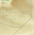
Fichier:Sool location relief map.svg

Taille de cet aperçu PNG pour ce fichier SVG : 585 × 592 pixels. Autres résolutions : 237 × 240 pixels | 474 × 480 pixels | 759 × 768 pixels | 1 012 × 1 024 pixels | 2 024 × 2 048 pixels.
Fichier d’origine (Fichier SVG, nominalement de 585 × 592 pixels, taille : 784 kio)
Historique du fichier
Cliquer sur une date et heure pour voir le fichier tel qu'il était à ce moment-là.
| Date et heure | Vignette | Dimensions | Utilisateur | Commentaire | |
|---|---|---|---|---|---|
| actuel | 2 janvier 2023 à 22:28 |  | 585 × 592 (784 kio) | Freetrashbox | Reverted to version as of 20:44, 1 January 2023 (UTC) See File talk:Sanaag location relief map.svg |
| 2 janvier 2023 à 04:36 |  | 585 × 592 (790 kio) | Siirski | Reverted to version as of 20:49, 31 December 2022 (UTC) *Regional border of Somaliland: SOMALILAND VULNERABILITY INDEX MAP / {{Cite web |author=Ministry of Planning and National Development of Somaliland |date= |url=https://mopnd.govsomaliland.org/site/downloadfile/file/MjAyMS8wNy8yMDIxLTA3LTA0LTA5LTEzLTQ3LTgtMTYyNTQzMzIyNy5wZGY%3D|title=SOMALILAND VULNERABILITY INDEX MAP |accessdate=2022-12-13}} | |
| 1 janvier 2023 à 21:44 |  | 585 × 592 (784 kio) | Freetrashbox | Reverted to version as of 11:50, 20 December 2022 (UTC) No source | |
| 31 décembre 2022 à 21:49 |  | 585 × 592 (790 kio) | Siirski | Corrected eastern border | |
| 20 décembre 2022 à 12:50 |  | 585 × 592 (784 kio) | Freetrashbox | Uploaded a work by Assemblied by User:Freetrashbox from ETOPO Global Relief Model with UploadWizard |
Utilisation du fichier
La page suivante utilise ce fichier :
Usage global du fichier
Les autres wikis suivants utilisent ce fichier :
- Utilisation sur en.wikipedia.org
- Utilisation sur si.wikipedia.org
- Utilisation sur uz.wikipedia.org
