Fichier:Standard Map of Xicheng District Administrative Boundary, Beijing(2019).jpg

Taille de cet aperçu : 414 × 599 pixels. Autres résolutions : 166 × 240 pixels | 332 × 480 pixels | 531 × 768 pixels | 708 × 1 024 pixels | 1 416 × 2 048 pixels | 3 437 × 4 970 pixels.
Fichier d’origine (3 437 × 4 970 pixels, taille du fichier : 3,01 Mio, type MIME : image/jpeg)
Ce fichier et sa description proviennent de Wikimedia Commons.
.jpg?uselang=fr)
Description
| Description |
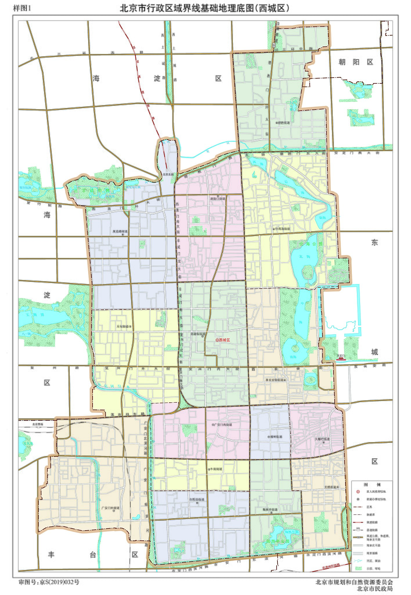
中文(中国大陆):《北京市行政区域界线基础地理底图》已根据《北京市规划和自然资源委员会、北京市民政局关于发布2019版北京市行政区域界线基础地理底图的通告》公布。 |
| Date | |
| Source | http://beijing.tianditu.gov.cn/bzdt/lib/xcq2019_w_1.zip |
| Auteur | 北京市规划和自然资源委员会、北京市民政局 |
Conditions d’utilisation
Copyright Law of the People's Republic of China: Article 5 This law shall not apply to:
|
 | |
|
This work is from any of the items above and is in the public domain in Mainland China and possibly other jurisdictions. For works whose copyright has expired, see also {{PD-China}} and {{PD-PRC}}. | ||
| This image of map is the Standard Samples for the Drawing of National Boundaries of China, the Reference Samples for the Drawing of National Boundaries between Countries in the World or Standard Maps of Administrative Boundary, which shall be promulgated by the State Council, the ministries and commissions under the State Council or the local People's Government in accordance with the law. So the copyright protection is inapplicable pursuant to Regulation on Map Management (Order of the State Council No. 664) and Article 5 of the Copyright Law of the People's Republic of China. |  |
Historique du fichier
Cliquer sur une date et heure pour voir le fichier tel qu'il était à ce moment-là.
| Date et heure | Vignette | Dimensions | Utilisateur | Commentaire | |
|---|---|---|---|---|---|
| actuel | 28 septembre 2020 à 08:54 | | 3 437 × 4 970 (3,01 Mio) | Patlabor Ingram | Uploaded a work by 北京市规划和自然资源委员会、北京市民政局 from http://ghzrzyw.beijing.gov.cn/zhengwuxinxi/tzgg/sj/202007/t20200706_1939265.html with UploadWizard |
Utilisation du fichier
La page suivante utilise ce fichier :
.jpg)