Fichier:Syria 2004 CIA map-2010-07-09.JPG
Taille de cet aperçu : 800 × 574 pixels. Autres résolutions : 320 × 229 pixels | 640 × 459 pixels | 1 004 × 720 pixels.
Fichier d’origine (1 004 × 720 pixels, taille du fichier : 127 kio, type MIME : image/jpeg)
Ce fichier et sa description proviennent de Wikimedia Commons.
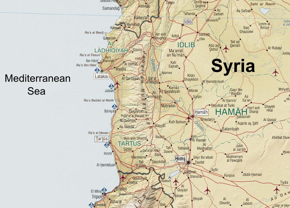
| Description | Syria. United States. Central Intelligence Agency. CREATED/PUBLISHED [Washington, D.C. : Central Intelligence Agency, 2004] NOTES "803011 (C00612) 1-04." Scale 1:1,300,000 ; Lambert conformal conic proj., standard parallels 32010'N and 38020'N (E 350--E 420/N 370--N 320). SUBJECTS Syria--Maps. Syria. MEDIUM 1 map : col. ; 66 x 66 cm. CALL NUMBER G7460 2004 .U5 REPOSITORY Library of Congress Geography and Map Division Washington, D.C. 20540-4650 USA DIGITAL ID g7460 ct001190 http://hdl.loc.gov/loc.gmd/g7460.ct001190 |
| Date | (UTC) |
| Source | |
| Auteur |
|
| Cette image a été retouchée, ce qui signifie qu'elle a été modifiée par ordinateur et est différente de l'image d'origine. Liste des modifications : Zoomed in at the An-Nusayriyah Mountains, removed the typing "Cape Apostolos Andreas" at eastern Cyprus, removed the Golan Heights zoomed map, replaced the name "Mediterranean Sea", added the name "Syria". L'image d'origine se trouve ici : Syria 2004 CIA map.jpg:
|
| Cette image est une œuvre d'un employé de la Central Intelligence Agency, réalisée dans le cadre des tâches officielles de cette personne. En tant qu’œuvre du Gouvernement des États-Unis d'Amérique, ce document est placé dans le domaine public aux États-Unis d'Amérique.
|

|
Journal des téléversements d’origine
This image is a derivative work of the following images:
- File:Syria_2004_CIA_map.jpg licensed with PD-USGov-CIA
- 2005-10-26T04:43:40Z Brian0918 3200x3178 (3495939 Bytes) Syria. United States. Central Intelligence Agency. CREATED/PUBLISHED [Washington, D.C. : Central Intelligence Agency, 2004] NOTES "803011 (C00612) 1-04." Scale 1:1,300,000 ; Lambert conformal conic proj., standard paralle
Téléversé avec derivativeFX
Historique du fichier
Cliquer sur une date et heure pour voir le fichier tel qu'il était à ce moment-là.
| Date et heure | Vignette | Dimensions | Utilisateur | Commentaire | |
|---|---|---|---|---|---|
| actuel | 7 septembre 2010 à 14:08 | | 1 004 × 720 (127 kio) | Supreme Deliciousness | {{Information |Description=Syria. United States. Central Intelligence Agency. CREATED/PUBLISHED [Washington, D.C. : Central Intelligence Agency, 2004] NOTES "803011 (C00612) 1-04." Scale 1:1,300,000 ; Lambert conformal conic proj., standard parallels |
Utilisation du fichier
Les 3 pages suivantes utilisent ce fichier :
Usage global du fichier
Les autres wikis suivants utilisent ce fichier :
- Utilisation sur ar.wikipedia.org
- Utilisation sur azb.wikipedia.org
- Utilisation sur az.wikipedia.org
- Utilisation sur bg.wikipedia.org
- Utilisation sur ca.wikipedia.org
- Utilisation sur en.wikipedia.org
- Utilisation sur es.wikipedia.org
- Utilisation sur it.wikipedia.org
- Utilisation sur lld.wikipedia.org
- Utilisation sur nn.wikipedia.org
- Utilisation sur pt.wikipedia.org
- Utilisation sur ro.wikipedia.org
- Utilisation sur ru.wikipedia.org
- Utilisation sur tr.wikipedia.org
- Utilisation sur uk.wikipedia.org
- Utilisation sur ur.wikipedia.org
- Utilisation sur vi.wikipedia.org
- Utilisation sur www.wikidata.org
- Utilisation sur zh.wikipedia.org