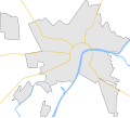
Fichier:Szeged map.svg

Taille de cet aperçu PNG pour ce fichier SVG : 664 × 599 pixels. Autres résolutions : 266 × 240 pixels | 532 × 480 pixels | 851 × 768 pixels | 1 135 × 1 024 pixels | 2 270 × 2 048 pixels | 901 × 813 pixels.
Fichier d’origine (Fichier SVG, nominalement de 901 × 813 pixels, taille : 19 kio)
Historique du fichier
Cliquer sur une date et heure pour voir le fichier tel qu'il était à ce moment-là.
| Date et heure | Vignette | Dimensions | Utilisateur | Commentaire | |
|---|---|---|---|---|---|
| actuel | 17 juin 2009 à 07:58 |  | 901 × 813 (19 kio) | BáthoryPéter | I found the problem... |
| 16 juin 2009 à 16:34 |  | 901 × 813 (20 kio) | BáthoryPéter | hmm, was it a demaged file? new export... | |
| 16 juin 2009 à 15:53 |  | 901 × 813 (20 kio) | BáthoryPéter | main roads | |
| 16 juin 2009 à 00:25 |  | 901 × 813 (16 kio) | BáthoryPéter | {{Information |Description={{en|1=Map of Szeged, Hungary}} {{hu|1=Szeged térképe}} |Source=own work |Author=~~~ |Date= |Permission= |other_versions= }} {{Inkscape}} <!--{{ImageUpload|full}}--> Category:Maps of cities in Hungary |
Utilisation du fichier
La page suivante utilise ce fichier :
Usage global du fichier
Les autres wikis suivants utilisent ce fichier :
- Utilisation sur bg.wikipedia.org
- Utilisation sur en.wikipedia.org
- Utilisation sur pl.wikipedia.org
- Utilisation sur pl.wikibooks.org
- Utilisation sur si.wikipedia.org
- Utilisation sur uz.wikipedia.org
