Fichier:The main causeway to Ynys Gaint - geograph.org.uk - 586380.jpg
Pas de plus haute résolution disponible.
The_main_causeway_to_Ynys_Gaint_-_geograph.org.uk_-_586380.jpg (640 × 480 pixels, taille du fichier : 99 kio, type MIME : image/jpeg)
Ce fichier et sa description proviennent de Wikimedia Commons.
Description
| Description |
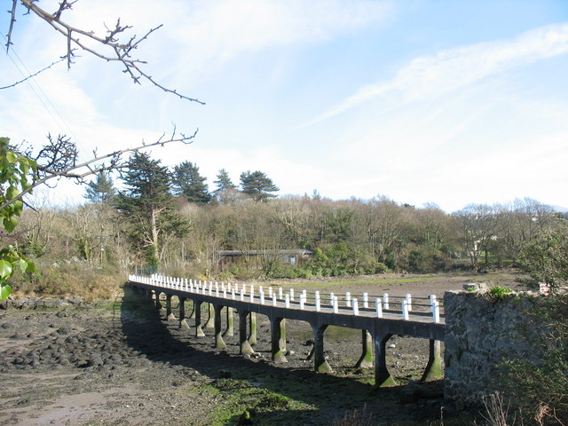
English: The main causeway to Ynys Gaint I spent many a weekend on Ynys Gaint when it was a base for the Royal Corps of Transport (Amphibious) [Wales]and used as a WTC for other units involved in mountain and water activities training. In those pre-breathalyser days it needed skill and a lot of luck to manoeuvre a long wheel base Land Rover back across the causeway after closing time on Saturday. Though the hutments are still on the island, and a parliamentary answer of 2002 lists Ynys Gaint as one of the MOD's bases on Anglesey, the only sign at the roadway end of the causeway nowadays is a 'Private. No Entry" sign. |
| Date | |
| Source | From geograph.org.uk |
| Auteur | Eric Jones |
| Attribution (imposé par la licence) | Eric Jones / The main causeway to Ynys Gaint / |
| Lieu de la prise de vue | | Voir cet endroit et d’autres images sur : OpenStreetMap |
|---|
_heading:157.00&language=fr)
| Position de l'objet | | Voir cet endroit et d’autres images sur : OpenStreetMap |
|---|
_heading:157.00&language=fr)
Conditions d’utilisation

|
Cette image provient de la collection du projet Geograph British Isles. Pour obtenir les coordonnées du photographe, veuillez consulter cette page de description de l'image sur le site du projet. Les droits d'auteurs sur cette image sont détenus par Eric Jones ; l'image est placée sous une licence Creative Commons avec mention de paternité et partage à l'identique (CC-By-SA) en version 2.0.
|
Ce fichier est disponible selon les termes de la licence Creative Commons Attribution – Partage dans les Mêmes Conditions 2.0 Générique
Attribution: Eric Jones
- Vous êtes libre :
- de partager – de copier, distribuer et transmettre cette œuvre
- d’adapter – de modifier cette œuvre
- Sous les conditions suivantes :
- paternité – Vous devez donner les informations appropriées concernant l'auteur, fournir un lien vers la licence et indiquer si des modifications ont été faites. Vous pouvez faire cela par tout moyen raisonnable, mais en aucune façon suggérant que l’auteur vous soutient ou approuve l’utilisation que vous en faites.
- partage à l’identique – Si vous modifiez, transformez, ou vous basez sur cette œuvre, vous devez distribuer votre contribution sous la même licence ou une licence compatible avec celle de l’original.
Historique du fichier
Cliquer sur une date et heure pour voir le fichier tel qu'il était à ce moment-là.
| Date et heure | Vignette | Dimensions | Utilisateur | Commentaire | |
|---|---|---|---|---|---|
| actuel | 6 février 2011 à 17:35 | | 640 × 480 (99 kio) | GeographBot | == {{int:filedesc}} == {{Information |description={{en|1=The main causeway to Ynys Gaint I spent many a weekend on Ynys Gaint when it was a base for the Royal Crops of Transport (Amphibious) [Wales]and used as a WTC for other units involved in mountain an |
Utilisation du fichier
La page suivante utilise ce fichier :
Usage global du fichier
Les autres wikis suivants utilisent ce fichier :
- Utilisation sur cy.wikipedia.org
- Utilisation sur da.wikipedia.org
- Utilisation sur en.wikipedia.org
- Utilisation sur nn.wikipedia.org
- Utilisation sur www.wikidata.org