Fichier:USGS Rikers Island.png

Taille de cet aperçu : 732 × 599 pixels. Autres résolutions : 293 × 240 pixels | 586 × 480 pixels | 938 × 768 pixels | 1 250 × 1 024 pixels | 2 501 × 2 048 pixels | 3 287 × 2 692 pixels.
Fichier d’origine (3 287 × 2 692 pixels, taille du fichier : 12,55 Mio, type MIME : image/png)
Ce fichier et sa description proviennent de Wikimedia Commons.
Description
| Description | |
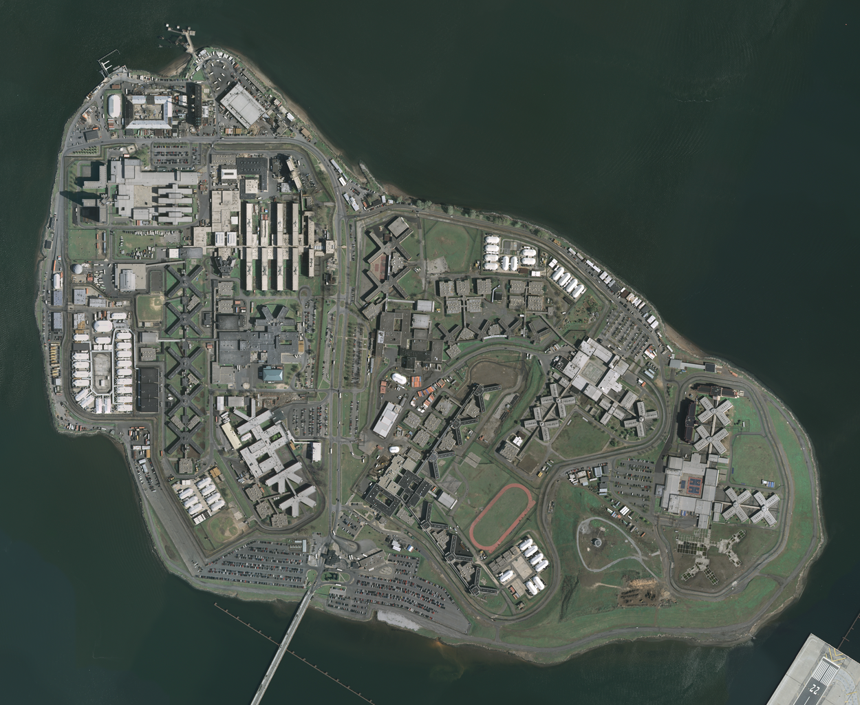
| Date | Acquired in march 2006; published by USGS in 2008; converted and uploaded to Commons on April 22, 2009. |
| Source |
The National Map Seamless Server, layer New York City (Mar 2006), latitude 40.79930093 to 40.78455349, longitude -73.89361276 to -73.86990631. Converted from GeoTIFF to PNG using GIMP. |
| Auteur | U.S. Geological Survey, conversion to PNG by uploader (Herr Satz). |
Conditions d’utilisation
Cette image est placée dans le domaine public parce qu'elle contient des éléments issus de l'United States Geological Survey, une agence du Département de l'Intérieur des États-Unis. Pour plus d'information, consultez la politique officielle de copyright de l'USGS (en anglais)
|
Historique du fichier
Cliquer sur une date et heure pour voir le fichier tel qu'il était à ce moment-là.
| Date et heure | Vignette | Dimensions | Utilisateur | Commentaire | |
|---|---|---|---|---|---|
| actuel | 22 avril 2009 à 14:19 | | 3 287 × 2 692 (12,55 Mio) | Herr Satz | {{Information |Description={{en|1=w:Orthophoto of w:Rikers Island.}} |Source=[http://gisdata.usgs.net/website/seamless/viewer.htm ''The National Map'' Seamless Server], layer [http://gisdata.usgs.gov/edc_catalog/fetch_layer_docs.php?LayerName=Ne |
Utilisation du fichier
Les 2 pages suivantes utilisent ce fichier :
Usage global du fichier
Les autres wikis suivants utilisent ce fichier :
- Utilisation sur ar.wikipedia.org
- Utilisation sur da.wikipedia.org
- Utilisation sur de.wikipedia.org
- Utilisation sur en.wikipedia.org
- Utilisation sur es.wikipedia.org
- Utilisation sur et.wikipedia.org
- Utilisation sur hy.wikipedia.org
- Utilisation sur ja.wikipedia.org
- Utilisation sur ko.wikipedia.org
- Utilisation sur lt.wikipedia.org
- Utilisation sur nl.wikipedia.org
- Utilisation sur ru.wikipedia.org
- Utilisation sur sr.wikipedia.org
- Utilisation sur uk.wikipedia.org