Fichier:United States System of Highways Adopted for Uniform Marking by the American Association of State Highway Officials.jpg

Fichier d’origine (8 972 × 5 851 pixels, taille du fichier : 18,59 Mio, type MIME : image/jpeg)
Ce fichier et sa description proviennent de Wikimedia Commons.
| Description |
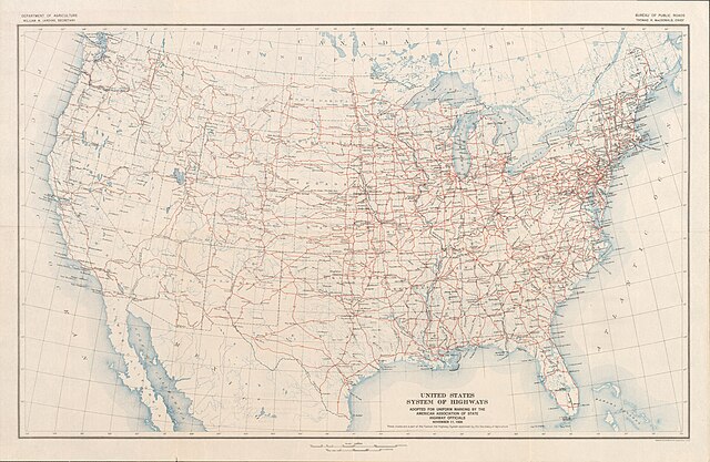
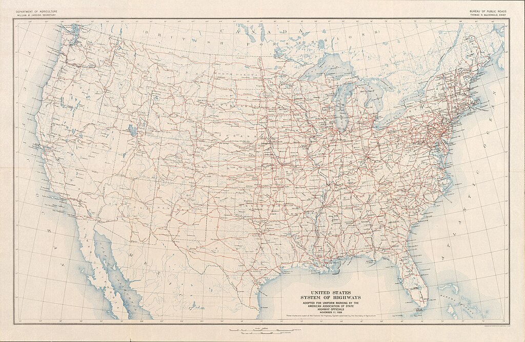
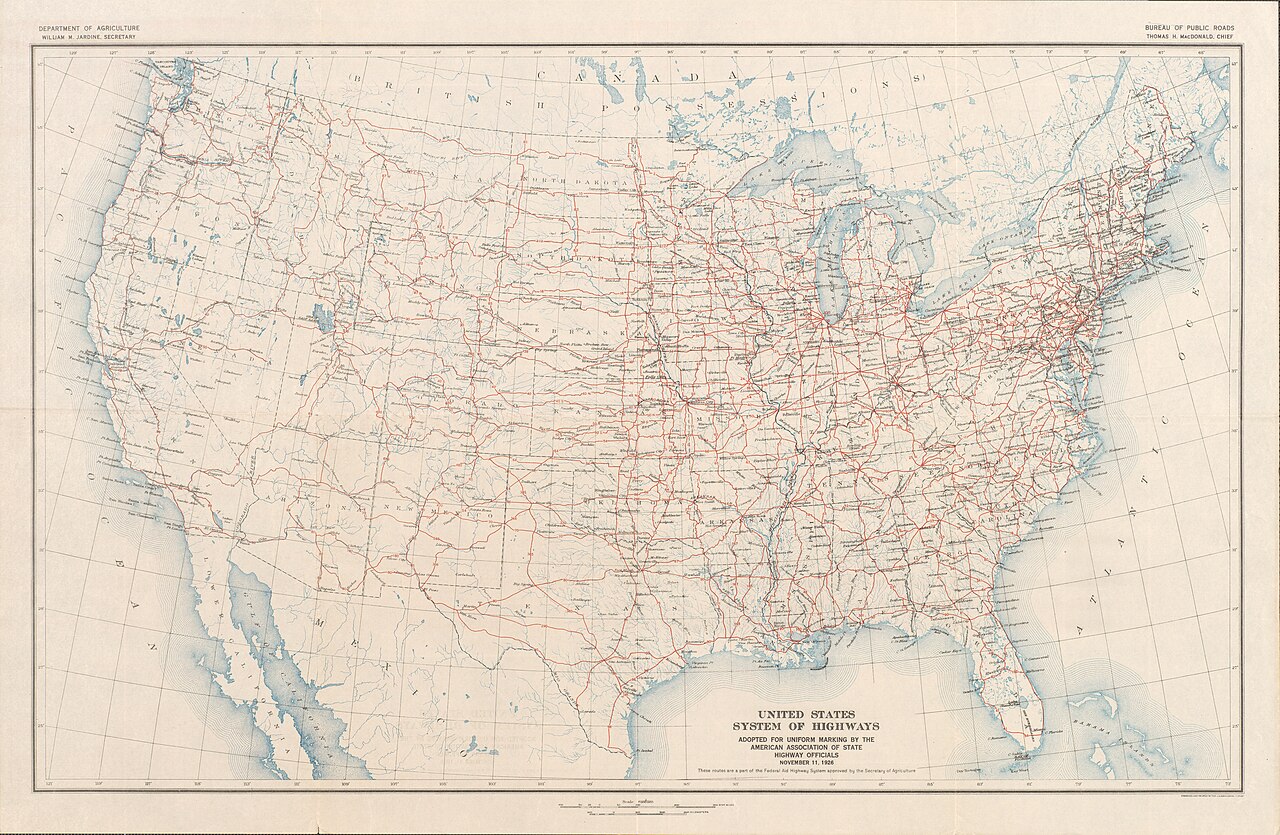
English: Map of the final U.S. Highway system as approved November 11, 1926
Français : Carte du système final US Highway comme approuvé en 11 Novembre 1926
日本語: 最終的な米ハイウェイシステムの地図は、1926年11月11日承認されました |
||||
| Date | |||||
| Source | Bureau of Public Roads & American Association of State Highway Officials (November 11, 1926). United States System of Highways Adopted for Uniform Marking by the American Association of State Highway Officials (Map). 1:7,000,000. Washington, DC: United States Geological Survey. OCLC 32889555. Retrieved November 7, 2013 – via University of North Texas Libraries. | ||||
| Auteur |
|
||||
| Autorisation (Réutilisation de ce fichier) |
|


Historique du fichier
Cliquer sur une date et heure pour voir le fichier tel qu'il était à ce moment-là.
| Date et heure | Vignette | Dimensions | Utilisateur | Commentaire | |
|---|---|---|---|---|---|
| actuel | 16 novembre 2013 à 02:18 | | 8 972 × 5 851 (18,59 Mio) | Imzadi1979 | replacing with higher quality scan that shows the full map |
| 2 mai 2006 à 05:40 |  | 4 475 × 2 694 (3,05 Mio) | SPUI~commonswiki | ||
| 2 mai 2006 à 04:23 |  | 4 475 × 2 694 (5,6 Mio) | SPUI~commonswiki | half size | |
| 2 mai 2006 à 04:16 |  | 8 950 × 5 387 (15,32 Mio) | SPUI~commonswiki | {{PD-USGov}} Map of the final U.S. Highway system as approved November 11, 1926. Scanned by the Oklahoma Department of Transportation and converted from [http://www.okladot.state.ok.us/hqdiv/p-r-div/maps/misc-maps/1926us.pdf this PDF]. [[Category:road map |
Utilisation du fichier
Les 2 pages suivantes utilisent ce fichier :
Usage global du fichier
Les autres wikis suivants utilisent ce fichier :
- Utilisation sur ar.wikipedia.org
- Utilisation sur de.wikipedia.org
- Utilisation sur en.wikipedia.org
- Utilisation sur ja.wikipedia.org
- Utilisation sur ro.wikipedia.org
- Utilisation sur uk.wikipedia.org
- Utilisation sur uz.wikipedia.org
- Utilisation sur vi.wikipedia.org
- Utilisation sur www.wikidata.org