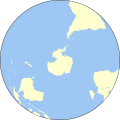
Fichier:Worldmap southern.svg

Taille de cet aperçu PNG pour ce fichier SVG : 553 × 553 pixels. Autres résolutions : 240 × 240 pixels | 480 × 480 pixels | 768 × 768 pixels | 1 024 × 1 024 pixels | 2 048 × 2 048 pixels.
Fichier d’origine (Fichier SVG, nominalement de 553 × 553 pixels, taille : 257 kio)
Historique du fichier
Cliquer sur une date et heure pour voir le fichier tel qu'il était à ce moment-là.
| Date et heure | Vignette | Dimensions | Utilisateur | Commentaire | |
|---|---|---|---|---|---|
| actuel | 1 mai 2013 à 13:31 |  | 553 × 553 (257 kio) | Gringer | updated... had the wrong width/height for orthographic |
| 1 mai 2013 à 13:27 |  | 1 103 × 1 103 (294 kio) | Gringer | updated script -- proper group ordering | |
| 29 avril 2013 à 01:59 |  | 552 × 552 (182 kio) | Gringer | updated perlshaper script (slightly larger image size) | |
| 3 septembre 2010 à 11:29 |  | 550 × 550 (397 kio) | Gringer | updated to use [http://www.naturalearthdata.com Natural Earth Data]. | |
| 21 octobre 2008 à 04:14 |  | 183 × 183 (341 kio) | Gringer | {{Information |Description={{en|1=A polar projection of the southern hemisphere from Image:Worldmap_wdb_combined.svg. Created from [http://www.evl.uic.edu/pape/data/WDB/ CIA World Databank data] using an updated version of my wdb2svg script, and clea |
Utilisation du fichier
La page suivante utilise ce fichier :
Usage global du fichier
Les autres wikis suivants utilisent ce fichier :
- Utilisation sur en.wikipedia.org
- Utilisation sur sl.wikipedia.org