Fichier:Coropgebieden plain.png
Taille de cet aperçu : 515 × 599 pixels. Autres résolutions : 206 × 240 pixels | 412 × 480 pixels | 660 × 768 pixels | 1 027 × 1 195 pixels.
Fichier d’origine (1 027 × 1 195 pixels, taille du fichier : 146 kio, type MIME : image/png)
Ce fichier et sa description proviennent de Wikimedia Commons.
Description
| Description |
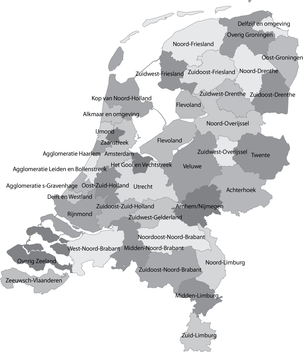
English: Map of the Dutch NUTS3 regions (COROP regions). Made using GIS software. |
| Date | |
| Source | Travail personnel |
| Auteur | Classical geographer |
| Autres versions | Œuvres dérivées de ce fichier : Islam in Netherlands.jpg |
Conditions d’utilisation
| Ce fichier est disponible selon les termes de la licence Creative Commons CC0 Don universel au domaine public. | |
| La personne qui a associé une œuvre avec cet acte l’a placée dans le domaine public en renonçant mondialement à tous ses droits sur cette œuvre en vertu des lois relatives au droit d’auteur, ainsi qu’à tous les droits juridiques connexes et voisins qu’elle possédait sur l’œuvre, sans autre limite que celles imposées par la loi. Vous pouvez copier, modifier, distribuer et utiliser cette œuvre, y compris à des fins commerciales, sans qu’il soit nécessaire d’en demander la permission.
|
Historique du fichier
Cliquer sur une date et heure pour voir le fichier tel qu'il était à ce moment-là.
| Date et heure | Vignette | Dimensions | Utilisateur | Commentaire | |
|---|---|---|---|---|---|
| actuel | 8 janvier 2011 à 14:04 | | 1 027 × 1 195 (146 kio) | Classical geographer | Updated Tholen/St. Philipsland (belong to Overig Zeeland, not to Rijnmond). |
| 28 juillet 2010 à 18:31 |  | 1 027 × 1 195 (209 kio) | Classical geographer | Without border. | |
| 28 juillet 2010 à 18:30 |  | 1 102 × 1 300 (211 kio) | Classical geographer | B&W and with more readable labels. | |
| 9 juillet 2009 à 13:31 |  | 1 199 × 1 407 (541 kio) | Classical geographer | Category:Maps of the Netherlands Category:Statistical divisions | |
| 9 juillet 2009 à 13:30 |  | 3 588 × 3 529 (553 kio) | Classical geographer | {{Information |Description={{en|1=Map of the Dutch NUTS3 regions (COROP regions). Made using GIS software.}} |Source=Own work by uploader |Author=Classical geographer |Date=2009-07-09 |Permission= |other_versions= }} [[Categ |
Utilisation du fichier
Les 2 pages suivantes utilisent ce fichier :
Usage global du fichier
Les autres wikis suivants utilisent ce fichier :
- Utilisation sur ar.wikipedia.org
- Utilisation sur ca.wikipedia.org
- Utilisation sur en.wikipedia.org
- Utilisation sur es.wikipedia.org
- Utilisation sur nl.wikipedia.org