Fichier:Paris suburbs Landsat.jpg

Taille de cet aperçu : 600 × 600 pixels. Autres résolutions : 240 × 240 pixels | 480 × 480 pixels | 768 × 768 pixels | 1 024 × 1 024 pixels | 2 401 × 2 401 pixels.
Fichier d’origine (2 401 × 2 401 pixels, taille du fichier : 1,29 Mio, type MIME : image/jpeg)
Ce fichier et sa description proviennent de Wikimedia Commons.
| Description |
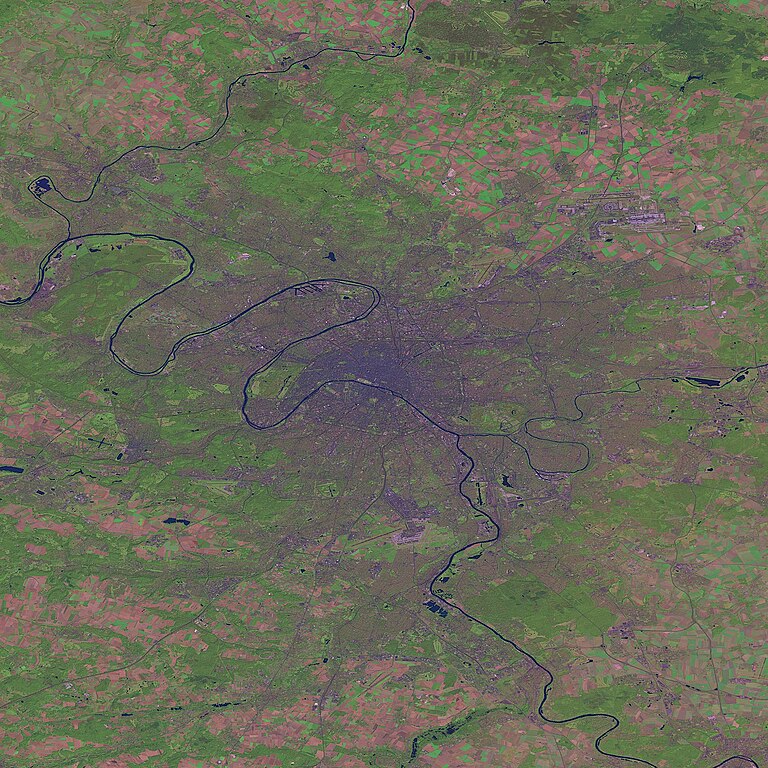
English: Paris and suburbs by Landsat. |
|||
| Source |
This image was generated by the NGA Raster Roam application, at coordinates 48°51'39"N 2°20'43"E.
|
|||
| Auteur | Landsat |

Historique du fichier
Cliquer sur une date et heure pour voir le fichier tel qu'il était à ce moment-là.
| Date et heure | Vignette | Dimensions | Utilisateur | Commentaire | |
|---|---|---|---|---|---|
| actuel | 26 octobre 2005 à 02:29 | | 2 401 × 2 401 (1,29 Mio) | David.Monniaux | Paris and suburbs by Landsat (false colours) {{NGA Raster Roam|latitude=48°51'39"N|longitude=2°20'43"E}} |
Utilisation du fichier
La page suivante utilise ce fichier :
Usage global du fichier
Les autres wikis suivants utilisent ce fichier :
- Utilisation sur vi.wikipedia.org